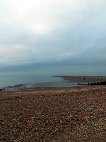
Dan and I set off from Home on the 8th of January 2017 for our first walk of the year. We arrived at Herne Bay at about 10am and parked up again on the seafront on Western Esplanade opposite Albany Drive, where the parking is free. On the beach was a group of people going for a bracing swim in the sea on a January morning. Mad? May have been willing to give it a go had I had the swimming stuff with me!
We walk a mile up Albany Drive to reach the Train Station, to catch the train from Herne Bay to the start of the walk at Faversham. I bought a single ticket for £3.80 and we waited about 20 odd minutes for the next train.
The train arrived and I'm sitting there and a whiff of dogs poo hit my nostrils, after a bit of shoe checking from Dan and I, I have indeed stepped in a pile! Lovely, the carriage smells great now!!
After a short journey we get off at Faversham station and after a short bit of map checking, we set off into town along Newton Road.
 |
| East Street Faversham |
A quick diversion onto East Street for a look. Here is a marvellous looking building occupied by The Stationary Shoppe.
They claim to be the longest-established shop in Faversham, and one of the
oldest in Kent. It was started as a bookshop in Court Street by Stephen
Doorne in 1767. Its present premises were new when it moved to them in
1864.
The names of Doorne and our other predecessors are recorded in gold leaf
on our splendid pastiche Tudor shopfront, installed to replace a
Victorian predecessor in the 1920s.
Particularly noteworthy are the grotesque figures clasping the coats of
arms of Faversham and Faversham Abbey. These were carved by a famous
wood-carver, William Warren, who also undertook commissions at the
Houses of Parliament.
We cut through Garfield Place onto Crescent Road and onto Court street.
 |
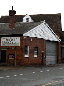
| Shepherd Neame Visitor Centre,11 Court Street |
There are no tours of the brewery on a Sunday, so a visit another day will have to do!
 |
| Guildhall on Court Street |
This is Faversham's third Guildhall. The first was on Guildhall Green
in Tanners Street, more or less where the Gospel Mission Hall now
stands. The town's early nucleus was in this area, but later its centre
of gravity moved to Court Street.
In about 1547 the Corporation built a new Guildhall where
the single-storey section of the Shelter Shop now is, on the east side,
at Middle Row's north end. Sometimes known as the ‘White House’
(presumably because it was lime-washed white), this was where Queen
Elizabeth I was entertained on her visit to the town in 1572.
Evidently the new building was not a success because in
1603 the Council moved to the present, third, Guildhall. This had been
built in 1574 as a market hall by community effort by the people of the
town and 13 nearby parishes.
What sets the Faversham Guildhall apart from most of its counterparts is
that it has a tower at one corner: in this respect it is more akin to
Scottish tolbooths. Though the building is not large, the hall and tower
still ‘float’ gracefully over the town centre, dominating Market Place
and forming Faversham’s focal point.
We pass the Shepherd Neame Brewery itself.
The Faversham Brewery is home to Shepherd Neame, Britain’s Oldest
Brewer. Nestled in the medieval market town of Faversham in Kent,
brewing has continued on this site for centuries.
Using natural ingredients, such as mineral water from the town’s
aquifer and local hops, the brewers produce Kentish ales bursting with
character and renowned international lagers.
While 1698 is the Brewery's official founding date, there is clear
evidence that its heritage pre-dates even this period. This timeline
details the significant events in the Company's history, from the first
brewers in Faversham to the arrival of the Shepherd family and the
Neames, right up to its current status as a successful, award-winning
business.
 |
| Favesham Sea Cadets Building. |
We pass Faversham Sea Cadets building on Conduit street by the river. This is a gorgeous old Tudor building.
We cross the bridge and follow the Saxon Shoreway path along side the river.
The Faversham name is of Latin via Old English origin, meaning "the metal-worker's village".
There has been a settlement at Faversham since pre-Roman times, next
to the ancient sea port on Faversham Creek, and archaeological evidence
has shown a Roman theatre was based in the town. It was inhabited by the
Saxons and mentioned in the Domesday book as Favreshant. The town was favoured by King Stephen who established Faversham Abbey, which survived until the Dissolution of the Monasteries in 1538. Subsequently, the town became an important seaport and established itself as a centre for brewing, and the Shepherd Neame Brewery, founded in 1698, remains a significant major employer.
The town was also the centre of the explosives industry
between the 17th and early 20th century, before a decline following an
accident in 1916 which killed over 100 workers. This coincided with a
revival of the shipping industry in the town. Faversham has a number of
landmarks, with several historic churches including St Mary of Charity, Faversham Parish Church, the Maison Dieu
and Faversham Recreation Ground. Faversham Market has been established
for over 900 years and is still based in the town centre.
 |
| The Albion Taverna |
Thankfully after a short walk I had the sense to check the map, Dan had suggested the wrong path! We were on the wrong side of the river to reach Seasalter so we walked back only adding a half mile diversion, could have been much worse!
On the right side of the river we walked along Belverdere Road and onto Abbey Road where we reach Standard Quay. Here there is a array of antique shops and eateries, offering creek side walking, shopping, eating and a chance see Faversham's living history.
Standard Quay is home for several classic ships and boats including
barges such as Cambria and Greta as well as traditional fishing boats,
classic tugs and overnight moorings of all sorts.
One of Standard Quay's classic 'barn' buildings, that dates
back to the seventeen hundreds, is the temporary home of the Cambria
Thames Barge Exhibition.
Standard Quay hosts regular events and plays a key role in
Faversham-wide activity such the towns Classic Transport Weekend.
 |
| Old English Tools Shop.. click on link |
 |
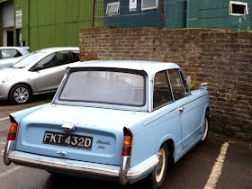
| A old 1966 Triumph Herald , the first of a few classic on the walk |
We pass Oyster Bay House, A warehouse said to have been built circa 1843 when the creek was improved. Oyster Bay House was built as a hop store in mid-Victorian times.
Shipbuilding on the Creek was an important local industry from at least
the 18th century. Several yards were established, and many vessels
built, including scores of sailing barges, without which London’s economy could not have survived.
 |
| A 1964 Morris Minor |
Pioneering imports of hops were arriving in the
Creek from at least as early as 1535. It was the use of hops that made
possible the brewing of beer, as opposed to ale. Beer kept better, had
better flavour, and was cheaper to produce
Thomas Arden was comptroller of Customs in Faversham when be was
murdered in his own home at his wife’s instigation in 1551. He can be
pictured striding down to Standard Quay and other town quays to check
that his staff were doing their jobs properly.
We strolled along The creek, and along slightly muddy paths but not to bad for the time of year.
 |
| Nagden House |
 |
| A look back to Faversham in the distance |
After crossing the Nagden Marshes and eventually out to the seawall. With Views across the mudflats to the Isle Of Sheppey. It was blissfully quiet here, just the eerily call of seabirds and the wind. It was quiet until a boat made it way along the river. Here on the mudflats I could see Shelduck and oystercatchers probing their way through the mud for a tasty morsel.
Across the water on The Isle Of Sheppey at Harty I could see St Thomas The Apostle Church built in 1089. There is a legend, reiterated when Mr Clarke's notes on Harty were
published in' the "Sheppey Church Magazine" in 1887, that the North
Aisle was built as a shelter for pilgrims in the reign of Henry III - possibly on their way by ferry North to follow the route to Walsingham, and South to Becket's shrine at Canterbury.
This church at Harty has no electric or gas connected. All lighting is by candles. Must visit one day!
After following the seawall alongside the Graveney Marshes we eventually reach Seasalter.
Historically, Seasalter came to prominence as a centre for salt production in the Iron Age,
and the resulting prosperity resulted in Viking raids on the area.
Later, the Domesday Book recorded that Seasalter "properly belongs to
the kitchen of the Archbishop" [of Canterbury]. In the 18th century, the
marshes were drained to create the Seasalter Levels.
 |
| The Sportsman PH |
The Sportsman pub, at the western end of the village by the marshes, on a
site which has hosted an inn since 1642, earned a Michelin star in
2008. During the Second World War it was the billet for a company of the 1st Battalion London Irish Rifles. In September 1940 these troops happened to successfully engage the crew of a crashed German airplane on nearby Graveney Marsh, and in 2010 to mark the 70th anniversary, a commemorative plaque was unveiled at the pub.
Further along the road we pass Waldens of Seasalter a caravan and chalet park that has been there for as long as I can remember.(Established in the 1960s).
 |
| A 1986 Citroen 2CV, can't remember the last time I saw one of these! |
I pass the many ditches on the marshes that bought back memories of a family holiday here in Seasalter where my brother and I , fished in the ditch and not expecting to catch anything he pulled out a dab!
We pass The Oyster Pearl PH, this used to be The Blue Anchor pub that I remember as a kid where my Nan and Grandad had a caravan on the park next door which is sadly now a park of residential chalets!
 |
| Bait diggers |
 |
| The former Blue Anchor caravan Park |
We follow the footpath along the shingled beach heading towards Whitstable.
Whitstable is famous for oysters, which have been collected in the area since Roman times and are celebrated at the annual Whitstable Oyster Festival.
The town was first recorded in the Domesday Book of 1086, under the name Witenestaple,meaning "the meeting place of the white post", which referred to a local landmark.
We reach Whitstable, again another town that has fond childhood memories, where my parents once had a holiday home. This has changed so much since then!
We walk along Island Wall with some gorgeous but I expect very expensive looking properties.
Whitstable Oyster Yawl 'The Favourite' is the last Oyster Yawl to remain
in Whitstable and in public ownership. She commemorates the oyster
fishing and shipbuilding industries that once thrived. Favourite is a
much loved part of the street scene in Island Wall, near the disappeared
shipyards, sail makers and forges once built on the beach.
Whitstable
Oyster Yawl 'The Favourite' was built in 1890, when dredging for
oysters was an important industry in Whitstable. In some years, up to
half the oysters sold in London came from Whitstable! Looking out to sea
a hundred years ago 80 or more of these sailing craft could be seen at
work.
Farming oysters is a better description than fishing as
the oyster may need to be sown on the sea bed, checked annually and
predators such as starfish removed before the four or five-year oyster
is harvested.
Favourite is the last Whitstable Oyster Yawl in
the town, although several other yawls are still sailing elsewhere. In
public ownership, she was rebuilt in 2006 using traditional materials
and methods.
In 1944, Favourite was machine gunned by a German
aircraft and beached to prevent her sinking. In 1952 she was hauled up
the beach into Harry Hurford-Jane's garden on Island Wall, just before
the sea wall was built.
 |
| Whitstable Oyster Yawl 'The Favourite' |
 |
| Whitstable High Street |
We stop on the beach for something to eat and drink by The Royal Native Oyster Stores.
The Whitstable Oyster Company can trace its origins back to the 1400s;
indeed, it is one of the oldest companies in Europe and has a long, rich
history of farming the famous Royal Whitstable Native Oyster. But
Whitstable oysters go even further back, almost two thousand years, to
when the Romans discovered them and, regarding them as a delicacy,
shipped them back live to Rome. More recently, and at the company’s peak
in the 1850s, it was sending as many as 80 million oysters a year to
Billingsgate fish market. By then the plentiful oyster had become the
food of the poor.
A large fleet of Whitstable smacks was moored off the beach to dredge
the oyster beds and the company flourished, but from the turn of the
century a number of factors conspired against the industry – cold
winters, the two World Wars, the great flood of 1953 and, not least, the
introduction of the prawn cocktail.
In 1978 Barrie Green and his business partner John Knight took over the
Whitstable Oyster Company. By this time it was practically defunct, with
large debts and an unfashionable product. Oyster production had hit an
all time low and one part-time dredger was left to sell a few dozen
oysters wholesale per week. Shortly afterwards the next generation,
Richard and James Green, opened the fish restaurant in the old oyster
stores and commenced production of the famous Whitstable Native.
More than thirty years later, we’ve come a long way and are hugely proud
of what we have achieved. We are still a family-run business and the
world-renowned Native Oyster is once again a cherished food. We have
invested heavily in the oyster beds and have created sustainable methods
of production that guarantee their future. This was recognised in 1997
when the beds were granted Protected Geographical Status by the European
Union.
We make our way up to Whitstable Harbour, this has changed dramatically since my childhood, here my brother and I would sea fish from the harbour and watch the fisherman unload their catch. Now its an array of shops and seafood stalls and far busier even in the winter than it was in the 80s.
I stopped by for a plate of cockles,a must do when by the sea! Smothered with Salt pepper and vinegar I walk on munching on these delicacies.
Up above us is Whitstable Castle. Whitstable Castle and Gardens or Tankerton Towers as it was first called
started life as a residence for the Pearson family in the late 1790s
and over its long history, it has been developed and improved by
successive owners and a Heritage Lottery Grant.
 |
| Looking back to the Harbour |
Below is a picture of people walking out onto Whitstable Street. The Street is a shingle strip about half a mile (750m) long that’s
exposed at low tide. Follow your Victorian forebears as you walk out to
the end, with the estuary’s waters on either side. Standing right out at
sea you can look back on the shingle beach and wooden groynes,
reminiscent of an England that is so familiar in postcards of old.
We now follow the beach through Tankerton.
Then passing past Swalecliffe and the empty campsite I stayed at last year Seaview we reach Studd Hill. Its seems forever and Herne Bay isn't getting any closer, its just round the next bend we said a few times, but alas no another false bend!!
Its now dark and started to rain, we pass the Hampton Inn at Hampton before climbing the hill into Herne Bay.
Once on top of the hill we can see Herne Bay and the journeys end.
The town began as a small shipping community, receiving goods and passengers from London en route to Canterbury and Dover. The town rose to prominence as a seaside resort during the early 19th century after the building of a pleasure pier and promenade by a group of London investors, and reached its heyday in the late Victorian era.
Its popularity as a holiday destination has declined over the past
decades, due to the increase in foreign travel and to a lesser degree
exposure to flooding that has prevented the town's redevelopment.
The town of Herne Bay took its name from the neighbouring village of Herne, two kilometres inland from the bay. The word herne, meaning a place on a corner of land, evolved from the Old English hyrne, meaning corner. The village was first recorded in around 1100 as Hyrnan. The corner may relate to the sharp turn in the minor Roman road between Canterbury and Reculver at Herne.
We reach the car, My strava app had recorded 18 miles but measuring on a map its 14.5 miles with the mile to the station that's 15.5 miles for the day.
We drive along the seafront and stop at Dean's Plaice for the customary Fish and Chips by the coast.
These didn't disappoint nice chips and crispy battered cod, We gave it 7/10!! Still doesn't beat the fish in Deal but still bloody good!
Then it was just a case of the drive home, another day day on the Kent Coast!


