On 24.03.19 I set off from home for the 40 minute drive to Sawbridgeworth in Hertfortshire on the Essex Border.
Viewranger file here
I arrive and park up in Luxford Place, not much parking here. I later see more parking over the bridge that's more appropriate.
I set off and after crossing the bridge I walk down alongside the River Stort (Navigation).
I am at Sheering Mill Lock.
Although a mill in Sheering was recorded in Domesday, it is not certain that that the site corresponded with the present position. The mill here was called Quickbury Mill in 1241 but the date of the change of name to Sheering Mill is not known. The Mill, closed in 1914, probably due to lack of demand for its produce. It was purchased by the Lee Conservancy and demolished in November 1917. The tail race tunnels are still visible. There is a miller's plate above the top gate.
The 1799 lock cottage lasted until 1980 but was then allowed to deteriorate, unoccupied, until it had to be demolished. However, the original plaster plaque that was over the front door, bearing the red hand of the baronet and Sir George Duckett’s initials (see above) still survives.
The old cottage was replaced by the present building in 2000.
The Stort Navigation is the canalised section of the River Stort runs 14 miles from the town of Bishop's Stortford, Hertfordshire, downstream to its confluence with the Lee Navigation at Feildes Weir near Rye House, Hoddesdon, Hertfordshire.
With the growth of the malt trade in Bishop's Stortford in the early eighteenth century, attention turned to providing better transport facilities. The River Stort joined the River Lea, and the malt trade at Ware had benefitted from improvements made on that river. A similar solution was therefore sought for the Stort, and a public meeting was held on 11 December 1758. The chief promoter seems to have been Thomas Adderley. A bill was duly submitted to parliament, and became an Act of Parliament in March 1759. It was entitled An Act for making the River Stort navigable, in the counties of Hertford and Essex, from the New Bridge, in the town of Bishop Stortford, into the River Lea, near a Place called the Rye, in the county of Hertford.
The 15 locks are built to take boats 86 feet (26 m) by 13.25 feet (4.0 m), which means that they are not quite wide enough to take two narrow boats at a time. The Navigation is now managed by the Canal & River Trust as successor to British Waterways.
Marshes survive in the valley to this day and the area is extremely important for birds, not only as a breeding ground and wintering area, but also as a feeding and resting place during migration.
Wet grassland provides insects, worms and other invertebrates as food for waterfowl and other birds as they pass. Breeding birds are numerous and include reed and sedge warblers, little grebe, water rail, moorhen, kingfisher and the occasional snipe. The area is also good for flocks of finches which in autumn and winter feed off seeds of teasel, thistle and other plants.
I now pass Feakes Lock (no.27)
Feaks Lock, not affected by a Mill. A foot bridge at the tail. The lower gates dated 1836. Upper ditto dated 1832.
I now reach Harlow Mill , where I cross the bridge and start to head back on myself.
Harlow is a former Mark One New Town and local government district in the west of Essex, England. Situated on the border with Hertfordshire and London, it occupies a large area of land on the south bank of the upper Stort Valley, which has been made navigable through other towns and features a canal section near its watermill.
After crossing the bridge I head back down along the opposite towpath.
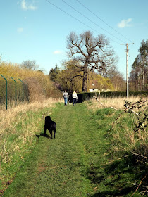
I take a path that heads away from the canal and across a field and river.
The path I'm on follows the Three Forests Way and Harcamlow Way.
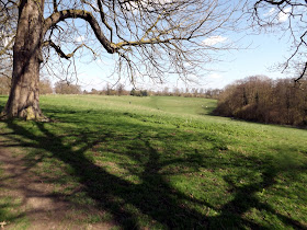
After crossing a road I came out into Pishiobury Park.
Pishiobury Park is a registered historic parkland (Grade 2 star) with a history that spans from the Neolithic period, with evidence of Roman occupation, links to Henry VIII and evidence of ‘Capability’ Brown style landscape features.
It is bounded to the North West by the A1184. The north east and south west boundaries are backed onto by residential properties. The south east boundary consists of wet woodland (The Osier Bed), grazed fields, flood meadows and the River Stort navigation.
The original park covered a much larger area, some retained as open land but privately owned and some developed for housing. The remaining 30 ha of parkland has been designated a County Wildlife Site and is laid largely to grazed pasture with scattered mature trees, roundels, hedgerows and woodland belts lining the perimeter.
I am now on a footpath that runs alongside housing before I emerge out into Sawbridgeworth.
Prior to the Norman conquest, most of the area was owned by the Saxon Angmar the Staller.
The Manor of "Sabrixteworde" (one of the many spellings previously associated with the town) was recorded in the Domesday Book. After the Battle of Hastings it was granted to Geoffrey de Mandeville I by William the Conqueror. Local notables have included John Leventhorpe, an executor of both King Henry IV and King Henry Vs' wills and Anne Boleyn, who was given the Pishiobury/Pishobury estate, located to the south of the town.
The mansion and surrounding land was acquired by Sir Walter Lawrence, the master builder, in the 1920s. In 1934, he instituted the Walter Lawrence Trophy for the fastest century in county cricket. He built a cricket ground and pavilion in the grounds where the great and the good of the cricket world came to play against Sir Walter's home team, which often included his three sons: Jim, Guy and Pat. Sir Walter also had two daughters: Molly and Gipsy. Great Hyde Hall was sold in 1945 and became a school. It is a Grade II* listed building and has now been divided into housing.
Much of the town centre is a conservation area; many of the buildings date from the Tudor, Stuart and Georgian periods.
 |
| The Market House,Kings Street |
The Market House Hotel was built as a house (a private hotel in 1937), and converted into a hotel / pub but I suspect this was long ago; it closed in 2010 for conversion back to residential use.
I now walk down Church Street to Great Saint Mary Church.
Great St Mary's was built from flintstone and mortar on a site that is believed to go back to pre-Domesday times (11th Century).
In the base of the tower is a 'Pudding Stone' which indicates that this had previously been an ancient pagan site of worship which had been adopted/converted to Christianity.
The churchyard contains a memorial to those who died in the two Great Wars. Amongst the gravestones can be found that of Joseph Vick, who was one of the few survivors of the valliant six-hundred who "rode into the valley of death" in the famous Charge of the Light Brigade in the Crimean War in 1854.
Great St Mary's Church is a Grade I listed building; "of special interest as a substantially unaltered large medieval parish church, typical of the Hertfordshire type, and with an outstanding collection of memorials of the highest artistic quality". It was originally built in the 13th century (although a church on the site existed in Saxon times) and includes a Tudor tower containing a clock bell (1664) and eight ringing bells, the oldest of which dates from 1749.It is unclear why it is "Great" St Mary's. Ralph Jocelyn of Hyde Hall, who was twice Lord Mayor of London, in 1464 and 1476, is buried here; images of many of his family and other locals have been engraved on brass, and hence the church is popular for enthusiasts of brass rubbing. The ghost of Sir John Jocelyn, known for his love of horses, is reputed to appear riding a white horse on the old carriage drive every 1 November.
The church has royal connections. Both Elizabeth I and Anne Boleyn, wife of Henry VIII worshipped here.
 |
| Sir John Leventhorpe, d.1625 & widow Joan, d.1627 |
I leave the church behind and head back Sheering Mill Lane.
Now after a bit of walking I'm back crossing the bridge back past Lock Cottage.
I cross back over the canal where two girls were getting ready to paddleboard,I'd love to try that one day!
Now after a lovely sunny walk of 4.2 miles I'm back at the car ready to drive home!


