I've been wanting to visit Dovedale for years, well I decided enough of waiting to see all these places and get out there and do it!
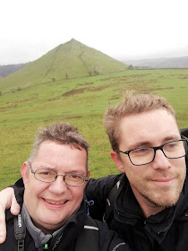
So at 0545 hours Dan and I set off from my home for the 161 mile drive to Ilam.
We arrived at about 0930 hours we arrived in Ilam after a horrible wet drive up. We parked up on Ilam-Moor Lane and donned our boots, at least the rain had eased up now.
We walk up the lane and the first thing you can't help to notice is The Ilam Cross.
Mary Watts-Russell Memorial Cross
Mary was the wife of Jesse Watts-Russell. Standing as a roundabout at the road junction where a lane branches off towards Blore, this is an ornate gothic-style obelisk of local limestone in the style of an Eleanor Cross. Standing on a three-step plinth, it has two tiers of statues surmounted by a spire with a cross at the top.
Just beyond the cross is a beautiful bridge over the River Manifold.
The River Manifold flows underground from Wetton Mill, and rises again at Ilam in the grounds of the hall. At some times of the year, the river bed is completely dry apart from the occasional pool. The River Hamps is a tributary of the Manifold which also flows underground leaving a dry river bed. At Ilam Hall, the Manifold rises a few yards downstream from a local spring. During certain weather conditions, when muddy water flows upstream of Wetton Mill, there is a clear difference between the clear water from the spring, and the muddy water rising just downstream.
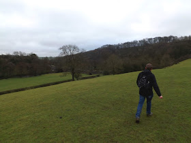
We cross the bridge and into a field that follows the River Manifold.
 |
| A pointless gate |
 |
| View across to the Flat top of Thorpe Cloud |
Now the mud started and we slipped and slided our way uphill.
We crossed over the river and onto the Limestone way to Thorpe.
We walk down into Thorpe and up to the church of St Leonards.
St. Leonards is an ancient church, the squat Normal tower being its greatest treasure dated circa 1100. The nave of early 14th century was rebuilt and extended in 1881. .
The first Snowdrops I've seen this year, a sign of hope that Spring is on its way.
The font is thought to be as old as the tower and is one of only three tub fonts in Derbyshire.
There is some attractive stained glass, including a delightful narrow St. Leonards window.
Thorpe, or 'Torp', meaning village in Old English is listed in the Domesday Book of 1086
We leave St Leonards and walk off through the village along Digmire lane before walking down Wintercroft Lane and onto the Thorpe Road.
We take a path off Thorpe lane onto Thorpe Pastures.
 |
| Bunsters Hill |
We make our way along paths with amazing views of these beautiful hills.
At the southern end of Dovedale between the villages of Thorpe and Ilam, stands Thorpe Cloud, 942 ft (287 m), an isolated limestone hill known as a reef knoll. It provides a viewpoint north up the dale and south across the Midlands plain.Its name "cloud" is a derivation of the Old English word cludwhich means "hill".
We fail to see the path now leads down into the valley and instead follow up to the top of steep Thrope Pastures.
 |
| View down into Dovedale Valley |
So we had the delight of descending down the steep hillside, Dan had a little more trouble than I as he was struggling with his dodgy knee.
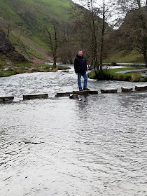
Anyway We are here! I am at last at the Dovedale Stepping stones! Been looking at pictures for years but now I'm finally here!
I am so glad I decided to go at this time of year to avoid the masses of tourists that descend here in better weather. We almost have the place to ourselves. A few passing walkers every now and then.
A beautiful river winding its way through a limestone gorge is so picturesque!
Dovedale is a valley in the Peak District of England. The land is owned by the National Trust, and annually attracts a million visitors. The valley was cut by the River Dove and runs for just over 3 miles (5 km) between Milldale in the north and a wooded ravine near Thorpe Cloud and Bunster Hill in the south. In the wooded ravine, a set of stepping stones cross the river, and there are two caves known as the Dove Holes.
Dovedale's other attractions include rock pillars such as Ilam Rock, Viator's Bridge, and the limestone features Lovers' Leap and Reynard's Cave.
The limestone rock that forms the geology of Dovedale is the fossilised remains of sea creatures that lived in a shallow sea over the area during the Carboniferousperiod, about 350 million years ago. During the two ice ages, the limestone rock (known as reef limestone) was cut into craggy shapes by glacial meltwater, and dry caves such as Dove Holes and Reynard's Kitchen Cave were eventually formed.
The caves were used as shelters by hunters around 13,000 BCE, and Dovedale has seen continuous human activity since. Around 4,500 years ago Neolithic farmers used the caves as tombs. There is evidence from Reynard's Cave of Bronze Age activity, and artifacts found there are displayed at Buxton Museum and Art Gallery.
Vikings settled in the area around 800 CE. Local place names such as Thorpe are of Scandinavian origin These settlements became permanent, and Thorpe is mentioned in the Domesday Book of 1086.
In July 2014 it was announced that a hoard of Late Iron Age and Roman coins has been discovered in Reynard's Kitchen Cave. The 26 coins discovered, which have been declared as "treasure", included three Roman coins that pre-date the Roman invasion of Britain, and 20 other gold and silver pieces of Late Iron Age date and thought to derive from the Corieltavi tribe. National Trust archaeologist Rachael Hall said: "The coins would suggest a serious amount of wealth and power of the individual who owned them." The coins were scheduled to go on display at Buxton Museum in late 2014.
The River Dove is a famous trout stream. Charles Cotton's Fishing House, the inspiration for Izaak Walton's The Compleat Angler, stands in the woods by the river. From Hartington to its confluence with the River Manifold at Ilam the River Dove flows through the scenic limestone valley known as Dove Valley, or Dovedale. From Hartington south to Ilam, a distance of eight miles (13 km), the Dove flows through Beresford Dale, Wolfscote Dale, Milldale, and then Dovedale.
We now follow The River Dove towards Milldale.
I can't help but marvel at the sight of the Limestone gorge, its rock formations,the gurgling river and the silence of it all! Heaven!
Dovedale is of special ecological interest for its plant life, particularly the calcareous ash woods, which are considered among the best in England.There are unusual plants such as Solomon's seal, lily of the valley, Paris quadrifolia and small and large-leaved lime trees.
A large number of Ash trees have been cut down after Ash dieback disease has hit here.
We reach the bridge that leads over to Ilam Rock.
 |
| Ilam Rock |
The limestone rock that forms parts of Dovedale is the fossilised remains of sea creatures that lived in a shallow, tropical lagoon about 350 million years ago. During the two ice ages, the limestone was cut into craggy shapes. Dovedale is famous for its numerous limestone rock formations. Ilam rock pictured here is one of the most spectacular, standing at about 25 metres high.
A quick look into a shallow cave beneath Ilam Rock.
Now back across the bridge, we walk on before reaching Dove Holes.
Dove Holes Caves are in the valley of Dovedale in the Peak District of England. The valley was carved by the two Ice Ages and subsequently the River Dove; and stretches for just over 5 km (3 mi). These dry caves were once used by hunters as shelters around 13,000 BCE and later, (4,500 years ago) as tombs by Neolithic farmers.
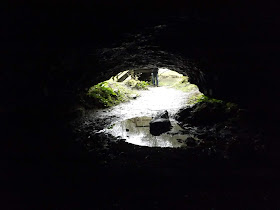
The caves lie beside a bend in the river Dove near Nab Dale in what is part of the Dovedale National Nature Reserve, designated in 2006 because of its diverse plant life and natural rock formations. Their oval forms were probably created by swirling meltwaters when massive glaciers filled the valley.
Dove Holes Caves are very accessible to walkers passing by on the path alongside the River Dove. The larger cave has a somewhat steep rocky entrance; the smaller is somewhat shallower. However, though they are impressive to look at, they are quite shallow with no deep passages leading off to explore.
 |
| View from Doveholes Caves |
Birds found here include common kingfisher, grey heron and dipper.
 |
A Dipper |
Now we approach Milldale.
The ancient, narrow packhorse bridge at Milldale originally had no side walls so that horses with panniers could cross the bridge without being impeded. Izaak Walton, who refers to himself as "Viator", which is Latin for "traveller", wrote about it in The Compleat Angler:
"What’s here, the sign of a bridge? Do you travel in wheelbarrows in this country? This bridge was made for nothing else – why a mouse can hardly go over it, tis not two fingers broad!"
From this the bridge acquired the name Viator's Bridge.
The bridge has been in use since the medieval period, for packhorses transporting silks and flax from nearby Wetton and Alstonefield. It is listed as an ancient monument.
Milldale is a village of stone cottages at the northern end of Dovedale and the main access point to the dale from the north. A corn mill existed until the mid-19th century, its stables are now used as an information hut by the National Trust.
A van pulled up and a man got out to service the toilets. A flock of ducks came running across from the river clearly recognising the van. On speaking to the man, he feeds them most days although he had nothing today. He told me he has two at home that were rescued after being hit by cars.
Anyway Dan feeds them a flapjack and they fight over the food and a few jump down at Dan!
 |
| Viator Bridge |
We walk off through the village, no tea room here at this time of year.
We take a path to our left and this starts climb sharply up through slippery mud!
Dan pushed himself on through the pain of his knee. We reach the top and stop for a cuppa. The wind up here is strong and the rain has started again. It was a bit bleak for sure.
We walk on through Grove Farm down towards Stanhope.
I apologise now for picture quality it was wet and bleak, I tried to keep camera lens clear of moisture but it was hard.
At the bottom of the track we reach Ilam Moor Lane and see Stanshope Hall to our right.
 |
| Stanshope Hall (B&B) |
We walk along the road and tractors are in the field, there is an awful stench in the air.
We reach the area where the path cuts across the fields, but as expected the fields were covered in slurry, that explains the smell. So not wanting to traipse through that we opt to stick to the road and alter our route.
We reach Hillside Animal Sanctuary where we were greeted by Alpacas.
Hillside Animal Sanctuary was founded in 1995 to help and campaign for animals in need' and most importantly, to bring public awareness to the millions of animals suffering every day in the intensive factory farming industry. Although at Hillside they have given sanctuary to over 2000 horses, ponies and donkeys, many of their residents have been rescued from the
farming industry.
After much fun with the alpacas we walk on.
We eventually dsecend back into Ilam.
 |
| Swiss style cottages |
We are back at the car, and rather than walk into Ilam Hall, we drive up to save our legs.
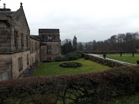
The estate was owned from the 16th century, for over 250 years, by the Port family. It was sold to David Pike Watts in 1809. On his death in 1816, the old hall was inherited by his daughter who had married Jesse Russell. Russell (as Jesse Watts-Russell, High Sheriff of Staffordshire in 1819 and Conservative MP for the rotten borough of Gatton) commissioned James Trubshaw to build a new Hall to designs by John Shaw; the Hall, now a Grade II* listed building, was built between 1821 and 1826.
By the early 1930s it had been sold for demolition. The demolition was well advanced when Sir Robert McDougal bought it for the Trust, on the understanding that the remaining parts (the entrance porch and hall, the Great Hall and the service wing) be used as an International Youth Hostel. Today Ilam Hall is leased to the Youth Hostels Association (England & Wales) (YHA).
The story of Ilam Hall is typical of many country houses. It was built on the riches of industry and became a showy country retreat for two prominent men. However, the advent of the 20th-century marked a rapid and quite remarkable decline in its fortunes.
The Ilam estate stands on land that used to be part of Burton-on-Trent Abbey. Around it sweeps the rich and lovely Vale of Ilam embellished with hanging woodland and views towards the swelling hills of limestone around Dovedale. At its extremity are the River Hamp and River Manifold, which after taking separate subterranean courses emerge and unite to form a wide river at the valley bottom.
We stop in the NT Cafe for tea and some crisps and a much needed rest.
 |
| Church of The Holy Cross |
Ilam has been a place of pilgrimage since the days of St Bertram, a Saxon saint and hermit who lived here, and today there are more 'pilgrims' (in the form of tourists) than ever. The saint was a Saxon prince of Mercia who travelled to Ireland to marry an Irish princess. On their way back to Mercia she had a child and they rested in the forest here while Bertram went off to seek food. When he returned he discovered that wolves had killed both his wife and child and, broken-hearted, he lived as a hermit around here for the rest of his life.
The saint's tomb lies in the church, a trim little building sitting apart from the rest of the village. The church was originally within the village - but the village was moved by Jesse Watts Russell to improve the view from the hall he built here in the 1820s. Some small parts of Saxon architecture may still be traced on the south wall where there is a walled-up old Saxon doorway, and there are the stumps of two Saxon crosses in the churchyard. Inside the church there is a magnificent Saxon font, which is worth a visit for itself.
 |
| St Bertrams Bridge |
St Bertram's Bridge was built on the site of an older bridge which carried the old Roman road across the River Manifold before the present bridge existed. St Bertram was a hermit and a disciple of St. Guthlac. Bertram - or Bertelin or Bettelin - was sometimes reputed to be the son of the ninth king of Anglian Mercia in the 'Dark Ages' after the Romans had abandoned their occupation of Britain. He lived in Croyland, England, and is listed as the patron of the town of Stafford. Bettelin and companions lived under the auspices of Croyland Monastery, founded by King Ethelbald of Mercia. Legend claims he was a noble who married an Irish princess who went into labour and gave birth in the forest while he went for help. Wolves ate her and the child in his absence. At once he denounced his heritage and spent the rest of his life as a hermit preaching the gospel. Canonisation was his belated reward for his successful conversion to Christianity of numerous pagan Britons. His nearby shrine became a point of pilgrimage in the Middle Ages and is reputed to be able to work miraculous cures.
Much of the church is Norman and Early English, (the tower is 13th century, for example), but there have been some notable later additions. The first is St Bertram's Chapel, built in 1618 by the Meverell family of Throwley Hall to house the saint's tomb, which is still a place of pilgrimage. Also in the chapel is the Meverell family's own tomb, a fine early 17th century edifice which is almost hidden by the organ. A more recent addition is the Chantry Chapel, added by Jesse Watts Russell in a Victorian Gothic style which jars slightly with the rest of the church. The chapel is a mausoleum to Jesse Watt Russell's father-in-law, David Pike Watts, and takes its name from the sculptor of the fine marble statue which depicts David Pike Watts on his deathbed.
We walk around from the tea-room and cross the Italian Gardens heading east towards St Bertram's well, which is just south of the church. This is said to have provided fresh water here since Saxon times. Just further on, St Bertram's bridge is the old bridge across the Manifold, and was the main crossing until the new bridge was built downstream in 1828.
We are back in the car after a 9.5 mile walk and drive to The Old Dog in Thorpe where we spend the night sleeping in the back of my estate car in the car park.
We spend the night in the pub eating and drinking.
There is a great selection of Ales, I have Sharps Atlantic ale and Dan a Betty Slogs.
 |
| Dans Hartington Bitter |
 |
| I opted for the Double Cheese and bacon burger with fries. Pretty much only burgers on the menu to be fair. |
We then order two pints of Flying Dog 'Doggie Style', a shock when we find out they are £6 a pint as they are imported!!!
A good nights sleep, then in the morning made a cup of coffee before setting off for Bakewell!


