GPX File Here
Viewranger File Here
On Monday the 22nd of March 2021, I drove to Wakes Colne where I parked at Wakes Colne & Chappel Train Station and East Anglian Railway Museum (CO6 2DS).

Colne Valley Railway visitors are able to enjoy:
a steam or diesel train ride on their demonstration railway,
large and interactive model railway,
updated museum and interpretation centre,
post office sorting coach – first time this has been opened for 18 months.
In addition, the entrance and reception building now features a coffee shop.

I leave the Station Car Park and walk down Station Road.

I cross the Colchester Road and get a view of the impressive Chappel Viaduct, more on this later when we visit on the end of the walk.


 |
| Nice Spring day at last and lovely to see the daffodils in the sunlight. |
I cross the bridge over The River Colne and walk up The Street. I am now in the village of Chappel.
 |
| A tree full of mistletoe. |
The present name of Chappel derives from the construction of a small chapel of ease, noted in 1285 AD as standing at the northern boundary of the parish of Great Tey. During the 16th century, because of concerns from Chappel residents about the distance to Great Tey's own church at festival time, this area was split from the parish and become a separate entity known as Pontisbright (lit. "Britric's bridge") that would eventually become known as Chappel.


Just pass this building I turn right and walk up passed St Barnabas Church.

In 1433, the vicar of Great Tey agreed that the inhabitants of Chappel could find and elect their own chaplain. The benefice itself was united with that of the neighbouring village of Wakes Colne in 1938. The chapel itself, now the parish church of St Barnabas, is a grade I listed building.

I walk on and cross the bridge over the Colne again to Wakes Colne Mill and House.

The mill dates from c.1850 (the earliest date for the Colchester pattern tie plates) and exemplifies the ingenuity which flowered as part of the Great Exhibition of 1851. Christopher Farrow worked both a corn and oil mill at Wakes Colne in 1848. By 1853 he was succeeded by George Clark Baker and in 1878 by J. Green (who also managed Ford Street mill). In about 1891 Robert Brooks took over as manager of the mill for E.M. Johnson. William Ashby bought the mill from Brooks, followed by his sons Arthur and Harry Ashby, who ran the mill, producing flour by waterpower up until about 1945. After the war they reverted to electric grinders due to the decreasing flour trade but latterly concentrated on the coal merchant side of the family business.

Part of the present site is still to this day in use as a coal merchants and is still owned and operated by the Ashby family.
 |
| Old Mill Stones. |
I cross back the way and came and continue along the path alongside The River Colne.
 |
| More mistletoe growing on a tree by the river. |

I follow the path over Old Hall Farm and pass a fishing lake.


I follow the path right now down towards Swanscomb farm and down behind and across waterlogged fields.


I reach Chalkney Mill.

Early C18, altered in C19 and C20.
The interior retains the wheel pit with an iron shaft by Whitmore and Binyon of Wickham Market, the wallower and wooden spur wheel. Built as a fulling mill it was converted for corn milling in the C19, with 2 1/2 storey extension at the right end and an engine house and tall chimney to the rear, demolished since 1974. Last used for milling in the 1930s

Henry Hills, owned Chalkney, Ford and Overshot mills (the latter is on the Peb) and in the 1870’s attended in London the first exhibition at which roller mills were demonstrated. He came back and told the manager at Chalkney that “they were out of business, sure as fate”. He wasn’t far wrong.
Chalkney Mill.The introduction of roller mills coincided with the import of large quantities of foreign wheat and sounded the death knell for the average water mill.The introduction of steam meant that water power was no longer necessary and before long all the business gravitated to rolling mills situated near ports or rail-heads.

I pass a friendly horse and should have turned left after the horses onto a path, but I miss this and walk up the lane a little too far before realising my mistake.


Stopping by another fishing lake , I realise I've gone too far and walk back and onto the correct path.
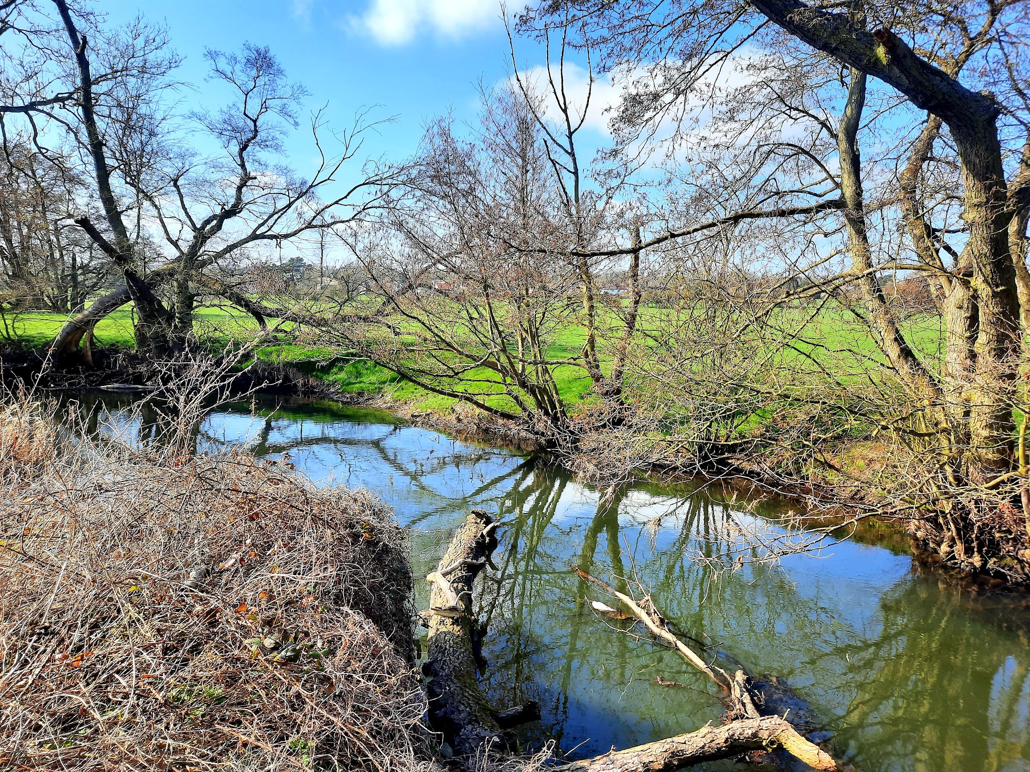
I am now following the River Colne again.
 |
| Spring colour in the form of Primroses beside the river path. |

I walk out onto Colneford Hill in White Colne.

I turn right up the hill to the green and the village sign.

White Colne traces its history back to the Domesday Book and beyond. There is evidence of Palaeolithic and Mesolithic settlement in the area. White Colne railway station was a station on the Colne Valley and Halstead Railway.

I follow the road back down and cross The River Colne again into Earls Colne.


Earls Colne is named after the River Colne, on which it stands, and the Earls of Oxford who held the manor of Earls Colne from before 1086 to 1703.

In the time of Edward the Confessor Earls Colne belonged to a Saxon noble named Wulfwine also recorded as Ulwin/Ulwine. Ulwin's whole estate was given to Aubrey de Vere by William the Conqueror. His grandson Aubrey de Vere III became the first Earl of Oxford in the mid-twelfth century.
The Earls had an ancient mansion called Hall Place standing near the site of the present Ashwells in Park Lane.
Edward de Vere, 17th Earl of Oxford mismanaged his finances and in 1583 the estate, then comprising the manor and park of seven hundred acres, were purchased from him by his steward Richard Harlakenden.

I take the path next to the house above and follow this beside the Earls Colne Priory.

A monastery, Colne Priory, was founded in the parish by Aubrey de Vere I in about 1103-4 and was dedicated to St. Mary and St. John the Evangelist for monks of the Benedictine order from Abingdon Abbey, Berkshire. The monastery was surrendered to Henry VIII of England by Robert Abel, the prior, on 3 July 1534.

There appeared to be no way of going in to see the priory which was a shame.

I walk on up the hill on my left and cross the road to reach St Andrews Church.


The site of current Grade 2* Listed building has been a church since medieval times. The earliest section (the south aisle) dates from 1360 with the tower, with the nave being completed in 1538. The north aisle, Lady Chapel and vestry were added in 1860.

I stop on a bench in the church grounds for lunch, before continuing on my way.

I walk down Church Hill and take a footpath behind houses before coming back out onto the round by a roundabout.

I now walk a short way along Coggeshall Road before taking a footpath next to the farm in the picture below.


I walk across farmland until I reach Tey Road which I follow for a way.
 Further up Tey Road I turn right up a track to Chalkney Woods.

I walk the extremely muddy paths of Chalkney Woods.

I eventually leave the woods behind as I join Swanscomb Road. I turn left and follow till I reach Greenlands Farm, where I take a footpath again.


I walk across more farmland.


I exit out of the farmland onto Oak Road opposite a lovely cottage.
I turn left up the road past a meat Wholesaler until I reach Popes Lane.

I follow Popes Lane under a railway bridge and up the lane.

I take a path on my left across a field towards Chappel Viaduct.

I reach Chappel Viaduct, been looking forward to seeing this.

The Chappel Viaduct is a railway viaduct that crosses the River Colne in the Colne Valley in Essex, England. It carries the Gainsborough Line which now is a short branch linking Marks Tey in Essex to Sudbury in Suffolk. The line previously, however, extended to Shelford in Cambridgeshire.
It was completed in 1849 by the Eastern Union Railway, which was later absorbed into the Great Eastern Railway. It is the longest bridge in the East Anglia region at 1,060 feet (320 m), and one of the largest brick-built structures in the country. It was listed at Grade II in 1967.

The viaduct consists of 32 30-foot (9.1 m) semi-circular spans, with tapered piers; it is 1,060 feet (320 m) long and rises to a maximum height of 75 feet (23 m). The piers consist of two shafts, separated by a 6-foot (2 m) opening, joined at the top and bottom by arches. Each shaft contains a hollow void up to 4 feet (1.2 m) by 3 feet (1 m), partially filled with concrete to the level of the bottom arch. The running level of the viaduct has a gradient of 1 in 120.

The seven million bricks used in the construction of the viaduct were made from clay excavated from the nearby village of Bures. It was built to carry a double-track railway but only a single track was laid. The bridge was built by Peter Bruff between 1847 and 1849 for the Colchester, Stour Valley, Sudbury & Halstead Railway, later part of the Great Eastern Railway.

The railway initially planned to build the viaduct with laminated timber but Bruff opted for brick to reduce the cost. He debated the cost benefits of brick compared to timber with the Great Western Railway's chief engineer Isambard Kingdom Brunel after a lecture at the Institution of Civil Engineers in 1850, Brunel being strongly in favour of using timber. Bruff went on to commission a painting of the viaduct by Frederick Brett Russell, which is now held by Ipswich Museum. Sources differ on the cost of construction; E. A. Labrum gives the cost as £21,000, while Historic England state a figure of £32,000 (both 1849).

A foundation stone in pier 21 was laid by the railway company's chairman and deputy chairman at the start of works in September 1847 and newly minted coins were placed inside as a souvenir. The stone and coins disappeared within a few hours of being placed and a bricklayer was later arrested, having tried to pay at a bar with a new half sovereign, but was not convicted of the theft due to lack of evidence.

I leave the viaduct behind and walk back up to The Street.

I turn right pass the 14th Century Swan Inn.


Chappel's village sign depicts a bridge crossing a river, symbolic of the old bridge, dating from 1140 AD, which crossed the river Colne and connected the two halves of the estate of Crepping Manor. The lord of the manor was, at that time, responsible for its upkeep.

I walk back up Station Road and back to the car after almost 8 and a half miles of a great walk.

I jump in the car and up to Colchester Brewery to buy a few beers.


Back in the car for the drive home!