GPX File Here
Viewranger File Here
On Wednesday the 21st of July 2021 I drove up to Earsham in Norfolk for a walk to Bungay in Suffolk. Yep this is a walk in two counties.
I park up for free by the roadside on The Street in Earsham. Just past The Queens Head PH pictured below. The Queens Head is home to Waveney Brewing Company.

Earsham is a small village in Norfolk, England. Its postal town is the nearby Bungay, Suffolk.
Earsham's name refers to its position within a stubble or earsh field in which plant material - wheat, barley or rye had been cut leaving a short stubble or short stalks.
I walk through a small housing estate before crossing the busy A143 and onto a footpath opposite.

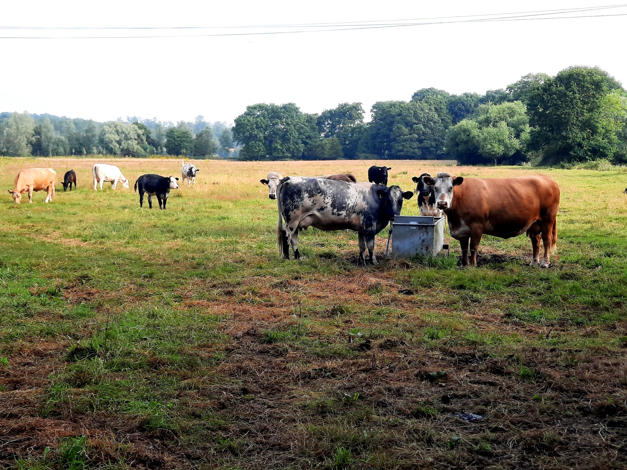
I pass Marsh Farm and its field of cows.
I then turn right up Bath Hills Road and follow the road pass Rookery Farm and is part of the Bigod Way.

The cottages above were built by two local men in 1927.

Bath Hills Road takes its name from this area which is locally known as The Bath Hills. The reference is thought to come from the early eighteenth century when a cold bath was established by an entrepreneurial apothecary and was to make Bungay a spa town in 1734.
Cold water health treatment had become fashionable in the Georgian period, when it was considered that both drinking the pure mineral water, and bathing in it, was remedial.
John King advertised his newly built resort in the Gentleman’s Magazine in 1734:
“Mr. King, apothecary in the pleasant town of Bungay, in Suffolk, has finished after Sir John Floyer’s plan a cold bath there, in a delightful situation and healthful air, everything is provided for the reception of such gentlemen and ladies as shall be advised, either to use the cold bath or mineral waters , of which there is an excellent sort in that place.”

I make room for a truck to pass making its way to the Earsham Gravels Ltd.

I pass several pits that are now a fishery and then pass Earsham Gravels Ltd itself.


I walk pass Valley House and continue to follow the road.

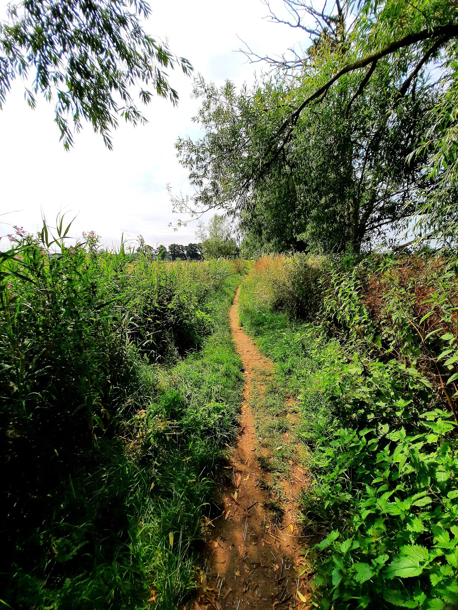
Now the road becomes a track and becomes more picturesque.


I pass Bath Hills Farm.
A small brick building is set in a steep hillside at the rear of Bath Hills Farm, across the Bigod Way footpath. It has a shaped gable to the southeast above, possibly modern, doors in the original doorway. There are windows in the side walls. It may be the bath that made Bungay a spa town.


Now Suffolk and Norfolk aren't renowned for hills, but a found one. Although not particularly steep or long ,it is a hill and up I climb.

 |
| A dead mole, I wonder if I will ever get to see a live mole in my lifetime, I imagine it must be a rare encounter. |

The views from the path, despite being partially hidden by the woodland, are amazing with sights across the river, the common and over into neighbouring Suffolk.

Along the path are hidden plagues and bits, to keep the kids interested on the walks I assume.


Down I descend to Outney Common as I do something to my right catches my eye a red animal, a fox? but then I got to see it properly, it's a Muntjac deer, watching me. But of course as soon as I go to take a photo it runs off!

Now as I walk across the bridges over the River Waveney and the common, I am taken back to the early 1980s as I spent much time here on Outney Meadows campsite in our Sprite Alpine caravan with my Mum, Dad ,brother, sister and our dog Butch. My Dad regularly worked away here decorating the local Martins Newsagent and I have had a fondness for Bungay ever since.

It is just as I remember it when my Dad took us on walks from the campsite. I vaguely remember a lavender field nearby too, but no idea where or if it stills exists!
 Here on the river was Baldrys Mill;
Ditchingham watermill was known to many as Rider Haggard's Mill. Although a mill on this site was documented as far back as 1240, the last structure disappeared c.1850. The story goes that part of the waterwheel was found near to where the mill used to be and was made into "something" for Lilias Rider Haggard. Along with Earsham and Ellingham it was one of the only three Norfolk watermills on the Waveney.
Back in the 1960s it was documented that the Oak timbered plates that supported the mill wheel still remain in the bank.
Baldry brought down to me a slab of oak which he is going to make into a stool. He had taken it out of the river bank by the old mill-race. There has been a mill on the spot for centuries, but the earliest mention I have found is in the Parliament Rolls as follows:
"William de Pirnhow in the 24th of Henry III released to Roger, Earl of Norfolk his right of fishery from the Mill of Cliff to the bridge of Bungay, and the Earl granted him a fishery from Bungay bridge to the Earl's Vineyard."
This would have been about the year 1250, and the mill was destroyed by fire about 1780 and never re-built. The plank formed the bed-plate of the mill wheel, and must have been under water for hundreds of years. There was some erosion of the wood on the surface, but when planed off it proved to be perfectly sound, completely black oak, as hard as iron.
Norfolk Notebook - Alan Sutton, 1946.


I crossed the bridge and walked up the river a short way, where I saw a likely spot that would be easy to get in and out of the river for a swim. The sun was now out and beaming down, it is another scorcher of a day, a cool down is just what I need.

After my swim, I dry off and sit on the bank for something to eat and drink. I watch some small chub in the river and throw a few morsels in for them which they eagerly attack.

As I sit I can see Bungay in the distance with the church tower peering between the trees.

I walk on across the common and come to the lake where my Dad took me and my brother fishing. Many a happy evening spent on the bank. It was also around here my Dad laid snares to catch a rabbit.
The campsite owner, showed my Dad how to skin and gut the rabbit. I remember him taking handful of guts and throwing them into the bushes.
That night my mum made rabbit stew and lied saying they swapped it with the butcher for one of theirs. Anyway wasn't convinced and I thought it tasted awful, never eaten rabbit since!


From the lake I took a quick sneaky peek at the campsite and walked past the security hut, didn't want to go too far, but wanted a look for old times sake.


I walk out to the roundabout and cross the A143 and up Broad Street, don't remember this part being industrial as a kid, maybe it was or wasn't I have no idea.

The origin of the name of Bungay is thought to derive from the Anglo-Saxon title Bunincga-haye, signifying the land belonging to the tribe of Bonna, a Saxon chieftain. Due to its high position, protected by the River Waveney and marshes, the site was in a good defensive position and attracted settlers from early times. Roman artefacts have been found in the region.
 |
| Probably been a while since that room was used as a smoke room in The Green Dragon PH on Broad Street. |


I pass Dragonfly Motorcycles that deal in Classic motorcycle spares.

I reach the market place and the Butter Cross.

The first official market was established in the 13th century, when the Bigod family still occupied the Castle. It was held on a Saturday but in 1382 Richard 11 granted permission for the weekly market to be held on Thursdays: and so it has continued ever since.
The Howard family, dukes of Norfolk, inherited Bungay Castle in 1483, and other property in and around the town. They also gained the rights and privileges of the market and received a regular income from them.
Originally, the market centre consisted of trader’s stalls clustered around a central stone cross, but by Tudor times, many of the traders had started to build permanent shops and dwellings around the market area, and the cross was replaced with a roofed building to provide shelter in bad weather.
In 1688, much of Bungay was destroyed or damaged by the Great Fire. The Market Cross was one of the first buildings to be replaced in order to re-establish trade as quickly as possible. Wooden steps inside the domed structure were provided where traders could sit and display their produce of butter, eggs, and cheeses, so it became known as the Butter Cross.

In 1754 a lead statue of Justice was placed on the top of the dome, as a symbol not only of fair trade in the market, but also because criminals awaiting court trials were temporarily imprisoned in a dungeon beneath the Cross, or in a cage above it. Other miscreants were put in the stocks on market day or received a public flogging. The wrist irons to which they were attached can still be seen on one of the pillars.
In 1871, the Town Reeve and Feoffees decided to purchase the rights and dues of the market from the Duke of Norfolk. They paid the sum of £40 for the privilege, and the Town Trust has managed the markets, and paid for the maintenance and repair of the Butter Cross ever since.
Although the market trade has declined in recent times, there is still a regular cluster of stalls, selling fruit and vegetables, bread, hot-dogs and other goods.
It adds bustle and colour to the street scene on Thursdays, and long may this ancient tradition continue.

I walked on and reach St Marys Church, that I could see from the river after my swim.

St Mary's was built as the church to a Benedictine priory. This was established in the late 12th century, but the main part of the present church dates from the 14th–15th century. The Domesday Survey records a church dedicated to the Holy Cross in the town, and it is thought that St Mary's stands on the site of an earlier Saxon church. The priory was closed in 1536 as a result of the dissolution of the monasteries, St Mary's became a parish church, and a grammar school was established in one of the priory's chapels. In 1577 the church was struck by lightning, and this event led to the Legend of the Black Dog.

The Legend of ‘The Black Dog of Bungay’
The most famous event connected with St Mary’s church is the apparition of the devil in the disguise of a Black Dog in 1577. During a storm on Sunday, August 4th, a terrifying thunderstorm occurred with such – “darkness, rain, hail, thunder and lightning as was never seen the like”.
Storms were always greatly feared during a period when most houses were built of timber and thatch and a lightening strike could quickly set large areas of a town ablaze.
As the people knelt in fear, praying for mercy, suddenly there appeared in their midst a great black Hell Hound. It began tearing around the Church, attacking many of the congregation with its cruel teeth and claws. An old verse records:
“All down the church in midst of fire, the hellish monster flew
And, passing onward to the quire, he many people slew”
Then as suddenly as it had appeared, it ran off, departing for Blythburgh Church about twelve miles away where it killed and mauled more people. Bungay Church was damaged, the tower struck by lightening and the Church clock was broken in pieces. Although there is no official record of injuries caused, the Churchwardens account book mentions that two men in the belfry were killed.
An image of the Black Dog has been incorporated in the coat of arms of Bungay and has been used in the titles of various enterprises associated with Bungay as well as several of the town's sporting events. An annual race, The Black Dog Marathon, begins in Bungay, and follows the course of the River Waveney and the town's football club is nicknamed the "Black Dogs". Black Shuck was also the subject of a song by The Darkness.
 Next door is the 19th century red brick Roman Catholic church of St. Edmund.

I walk back up to the Butter Cross, cross the road and buy a couple of beers to drink later at home, Adnams Broadside and Southwold Bitter from the Bungay Shopper.
I walk on down to Bungay Castle.

Originally this was a Norman castle built by Roger Bigod of Norfolk, around 1100, which took advantage of the protection given by the curve of the River Waveney. Roger's son, Hugh Bigod, was a prominent player in the civil war years of the Anarchy, and his loyalty was called into question during the early years of the reign of Henry II. Henry confiscated Bungay, returning it in 1164. Hugh went on to build a large square Norman keep on the site in 1165. It is not recorded how much it cost to build the keep, but Hugh Braun who led the excavations at the castle in the 1930s estimated that it would have cost around £1,400. Hugh ended up on the losing side in the Revolt of 1173–1174, Bungay was besieged, mined and ultimately destroyed by royal forces.

The site was subsequently restored yet again to the Bigods and was further developed in 1294 by Roger Bigod, 5th Earl of Norfolk, who probably built the massive gate towers on the site. Roger fell out with Edward I and after his death the castle reverted to the Crown, falling into disrepair and ruin. From 1483, it was primarily owned by the Dukes of Norfolk until the 20th century.

 I walk through to The Castle Inn but its closed till Thursday!
I walk on down Earsham Street and out of Bungay's centre.


I walk down to the bridge over the River Waveney.


I take the footpath on the left hand side of the bridge and follow this along, the air is full of blue damsel flies and the occasional dragonfly.


I follow the path towards Earsham.

To my left in the distance is Flixton Road Mill(now a grade II listed residence).
Flixton Road Mill was a six storey tower mill with a boat shaped cap. It had four Patent sails of ten bays and was winded by a fantail. There was a stage at second floor level and the mill drove three pairs of millstones. Auxiliary power was by an engine, with the external drive belt enclosed in a wooden casing.


I cross the bridge over the river and down Church Road.

I reach All Saints Church in Earsham.

This church is said to have stood in an extensive area of earthworks . Levelling of these recovered Early Saxon pottery and cremations suggesting there was an Early Saxon cemetery here before the churchyard. The present building is a Saxo-Norman or Norman structure. It was extended eastwards around 1300 when the tower was also added. There are many Perpendicular details, some of which were rebuilt in the 19th century. An evaluation was carried out in advance of a new extension in 1994. An undated feature, medieval fragments of pottery and a prehistoric flint flake were found.


I turn right by the house below and walk back through some housing.


I come back opposite The Queens Head Ph which is closed till midday, still half hour away, so I decide to just drive home. a Great 6 and a half mile walk.
