Myself and Dan left Romford for the 236 mile trip to Pitton Cross Campsite at 5am hoping to miss any traffic. We arrived on site at 945am after a 30 minute stop off at some services for coffee.
The site were very helpful and let us on our pitch early as the site wasn't too busy this time of year.
The site was clean and the shower/toilet block was clean although cold when stepping out of the shower.

Anyway we set up our tents, had a quick cuppa before heading into Rhossilli.

 |
| View to the sea at Mewlade Bay from the Campsite |
Rhossili Bay has been voted into the top four of Britain's Best Beach
by TripAdvisors Travellers’ Choice for four years running AND was the
first beach to be awarded Britain's Best Beach for two years in
succession!

We parked up paid the daily £4 parking fee (Free if you are NT members). We walked through into The Bay Bistro for a cup of tea. We were still early for The Walking For Pleasure Meet up today.
Next to the Bistro, is Sams Surf Shack. Visitors can hire surf boards, wetsuits and buy accessories.

We stepped outside to get our first proper look at the amazing stretch of beach here in the bay, I forgot how gorgeous it was, its been 7 years since I was here last!


The Times nominated Rhossili as ‘The UK's No.1 dog-friendly beach’.
So, it’s pretty much universally agreed that you won’t find a more
beautiful spot in the UK.


It was still going to be a while before everyone turnt up so we headed down onto the beach.


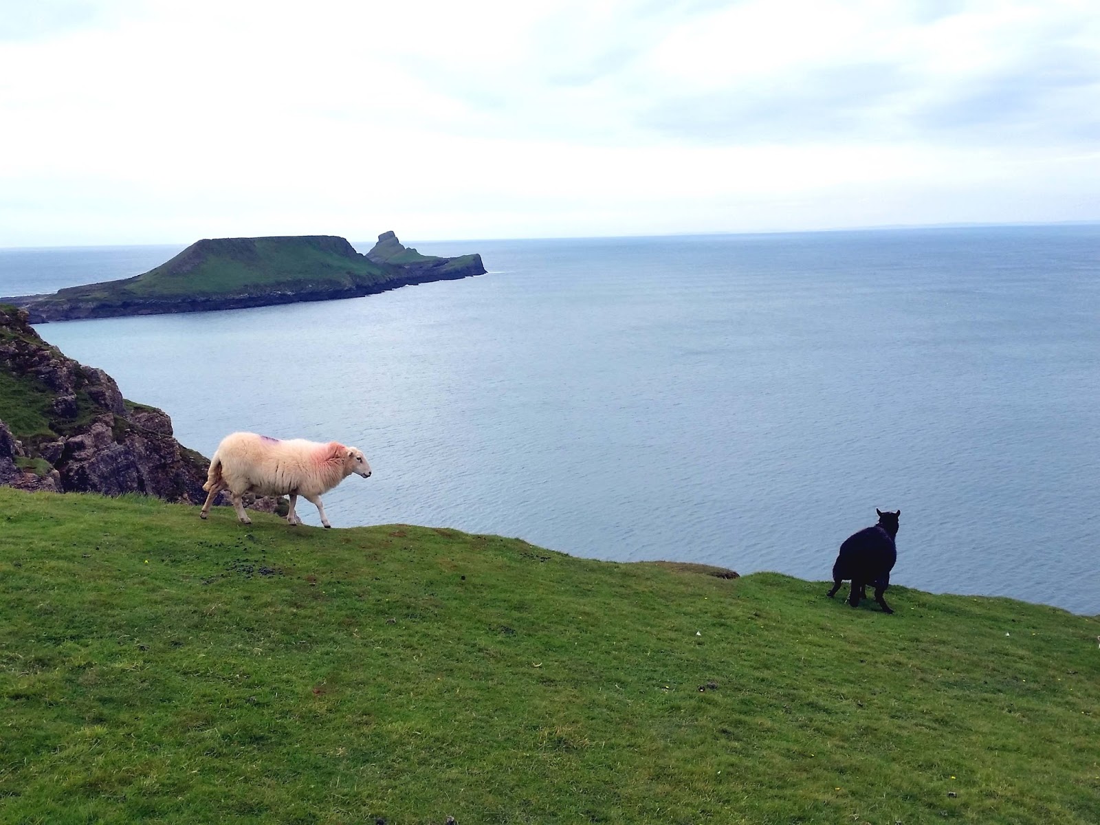
 |
| View to Wormshead |
Down on the beach, we stopped by the Helvetia shipwreck with amazing views to Wormshead beyond.

The wrecking of the Helvetia
The gales around the Gower coast on the morning of 1st November 1887
caused two ships, heavily laden with timber, to be stranded off Mumbles'
Head. Unable to navigate the stormy seas to dock at Swansea Harbour,
the struggling ships found themselves being blown down the Bristol
Channel by the increasingly strong south-easterly winds. One ship
luckily managed to reach the shelter of Lundy Island, but the
oak-constructed barque of the Helvetia, struck the dangerous sandbank of
Helwick Sands. With the next turbulent swell, the ship gained freedom
from the shallow waters but was swept precariously around Worm's Head into the shallow waters of Rhossili Bay.
The captain of the Helvetia dropped anchor here and was taken ashore
by the coastguard. However, he refused to abandon his ship altogether,
leaving the crew aboard the barque, afraid that given the chance,
someone might steal her. Unfortunately, the wind refused to die down and
when it changed direction suddenly, it forced the ship to drag her
anchor. With nightfall rapidly approaching, the decision was finally
made for the crew to abandon ship. The tortured wreck of the Helvetia
was discovered the next morning, laid to rest upon the sands and
surrounded by her cargo of 500 tons of wood.
During the following weeks the timber was systematically collected
from the beach and gathered for auction sale, where South Wales timber
merchants purchased the cargo at a bargain price. Arrangements were made
for the timber to be taken by ship during the summer months. It was
during this phase of the wood clearance operation that the sea brought a
second disaster to the area.
The steamboat Cambria, from Llanelli, and a small Mumbles
sailing vessel, having loaded the Helvetia's timber from the bay, were
both caught short by the tide. The captain of the sailing vessel carried
his anchor out to low water to assist in leaving the bay later, but the
propeller driven Cambrian needed to wait for high tide.
As the tide came in, the wind picked up pace causing the waves to
intensify and swell. As the Cambria started to float with the rising
water, it unfortunately turned sideways onto the strengthening waves,
and looked as if it would surely be wrecked. However, with the help from
the coastguard, the ship was stabilized and the crew managed to sail
away safely later the same day. The ship's anchor had been left behind,
however, and so some local men were hired to carry the anchor over the
sands at low water, to the nearby area of the bay known as Kitchen
Corner. There they attached a buoy to the anchor, making it ready for
collection when the ship returned later.
When the ship returned to the bay several months later, the Cambria's
master sent a boat ashore with some day-tripping landlubbers. After
spending the day at the Rhossili public house 'The Ship Inn', these men
finally recovered the anchor. Unfortunately, the weight of the anchor,
accompanied by the weight of the six rescuers, proved too much for the
boat, eventually causing it to capsize. All six men were thrown into the
ocean. Only one of the men made it to the shore alive.
The wreck of the Helvetia itself was sold cheaply to a local man, but
before he had a chance to strip the precious copper keel from the
vessel, she had started to settle in the sand. Nevertheless, he made
good salvage of the ship's deckboards by flooring his kitchen with its
wood.


The rest of the WFP group arrive after being stuck in Traffic for a while travelling from North Wales. So myself,Dan,Max,Julie,Heather,Steve and Clive set off to walk across onto Wormshead.

Worm's Head
Historically named 'Wurm' meaning 'dragon' by Viking invaders, the
promontory, Worm's Head, is shaped like a giant sea-serpent and marks
the most westerly tip of Gower. The island is joined to the mainland by a
rocky causeway and features an large flat-topped 'Inner Head', towards a
natural rock bridge called 'Devil's Bridge', a 'Low Neck' leading
further out to the 'Outer Head'. The headland is one mile long and the
highest point is approximately 150 feet.

The rocky, jagged causeway leading out to the 'Worm' is only exposed
for two and a half hours before and after low tide, so walkers should
always carefully check the tide times before they set off over the
causeway. Being trapped on Worm's Head for half the day, waiting for low
tide again, is both inconvenient and desolate to say the least, but so
easily done by the inexperienced. Even the young Dylan Thomas made the mistake of falling asleep on the Inner Head and missing his tide:
I stayed on that Worm from dusk to midnight, sitting on that top grass, frightened to go further in because of the rats and because of things I am ashamed to be frightened of. Then the tips of the reef began to poke out of the water and, perilously, I climbed along them to the shore.
- Dylan Thomas.

Dylan Thomas used to regularly visit Worm's Head and in his short story, 'Who Do You Wish Was With Us?', he wrote:
... Laughing on the cliff above the very long golden beach, we pointed out to each other, as though the other were blind, the great rock of the Worm's Head. The sea was out. We crossed over on slipping stones and stood, at last, triumphantly on the windy top. There was montrous, thick grass there that made us spring-heeled and we laughed and bounced on it, scaring the sheep who ran up and down the battered sides like goats. Even on this calmest day a wind blew on the Worm.
- Dylan Thomas


View down to the old Lifeboat house that's now disused, myself and Max will visit this later.

Outside the coastguard office are the tide times, there's a mere 2 and a half hour window to walk across the causeway. We were good to go!


Here a few stayed back as the crossing across the causeway isn't easy
going, I just think it was an excuse to get to the pub early !


Worms Head itself is shown on the OS map divided into three sections -
the Inner, Middle and Outer Heads. In fact they are all joined though
the rough tooth like low, rocky section linking the Inner and Middle
Heads can be swamped with storm waves at high tide. Seals are resident
on the Worm but to see them you must keep quiet and keep a low profile
if peering over the cliffs to see them because they'll take fright if
they see your profile silhouetted on the skyline. The top of the Inner
Head can again be seen to be perfectly flat showing that it was once a
beach level the same as that on the shore.

So myself,Max,Dan and Steve battled on towards the headland.


The bell here is used if you become trapped by a rising tide, you ring continuously for help from the coastguard.


Breeding Seabirds
The Outer Head is a breeding ground for birds such as Herring Gulls,
Guillemots, Razorbills, and Kittiwakes, with the occasional appearance
of Puffins.
At the end of the humped and serpentine body, more gulls than I had ever seen before cried over their new dead and the droppings of ages.
- Dylan Thomas
Walkers are requested not to climb to the top of Outer Head between 1
March and 31 August, to avoid disturbing these nesting birds.


Here Dan and I split ways with Max and Steve, we went up and over the headland whilst Max and Steve stayed on the low path.

Coming down the steep incline , Dans knee started to hurt so he decided this was as far as he was going today, to save his knee for tomorrows walk.

Now another rocky outcrop to cross, much harder than the first, Myself,max and Steve battle on across.
Crossing onto the Middle Head you are at once confronted by the Devils
Bridge. This is all that remains of a collapsed sea cave and this arch
will eventually collapse too, dividing the Middle Head in two.
Now we cross the impressive Devils Bridge, a superb sight !


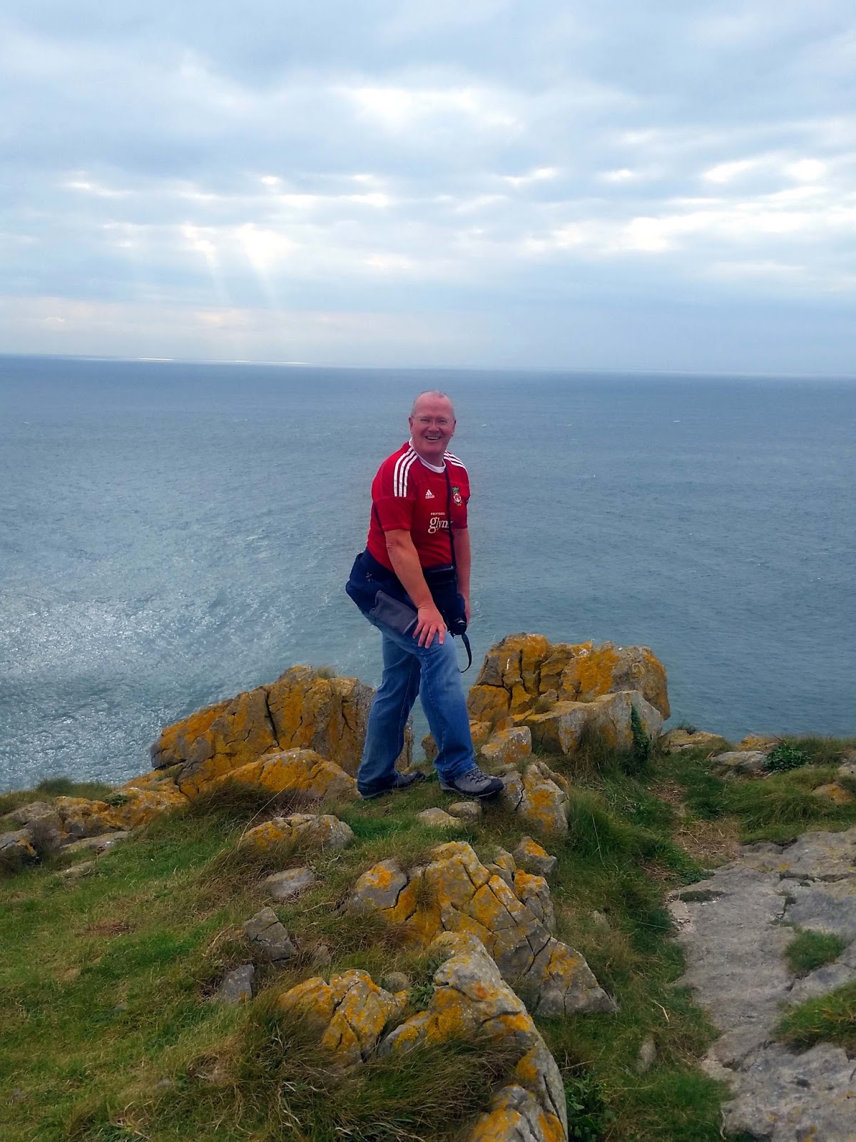
Myself and Max walk on and up to the head, where we have a grade 1 scramble up to the top.
Ever since 2009 when I was last here, I look back and wish I'd walked the Worm and here I am at last. Another bucketlist wish ticked off!


 |
| It was a tad windy up there ! |

Now we walk back and meet back up with Steve, and we continue back.

Towards the end of this middle section, another
truncated cave gives a window through which you can look along the
north wall of the worm.


Just down past the cave we see a seal in the sea and another basking on the rocks in the sun.


 |
| A dead dogfish we found. |


Here on the causeway we found the anchor belonging to The Samuel Shipwreck. The Samuel was a Norwegian coal ship.
The ship ran ashore at 7pm on Tuesday 12th February 1884, along with
several hundred tonnes of black gold (coal) whilst on a routine trip
from Cardiff to Santos. The alarm was first raised by the local
coastguard at Rhossili who saw the ships lights close inshore.
Fortunately the coastguard was able to get a line aboard and rescue all
eleven crew members. Samuel however was already badly damaged and eventually broke up on the rocks.
As always the locals were available to take advantage of these
unfortunate events. After the coal cargo had been sold to local farmers a
rough track was cut down the cliffs at Rhossili to allow the
transportation of the coal back up to the village. This was then sold on
to the locals who were able to keep themselves warm through winters for
years to come. The only evidence now left is the anchor, providing a
stark reminder of the perils of these waters.

Dan and Steve walk on to The Coastguard Station whilst Max and I divert off to our left to have a look at the Disused Lifeboat Station.


After a brief look about we headed back up to the Coastguard station and back to Rhossilli where we met the rest in The Helvetia Bar in The Wwormshead Hotel for a debrief and a pint of Wormshead Ale.


After a short while Dan and I said goodbye to Max,Julie,Heather,Steve and Clive and headed back to the campsite and got our Fish and chip supper. A great walk indeed !


