Sunday 20 August 2017

Lligwy Bay to Moelfre and back 15th August 2017


On the 15th August 2017 My son and I set off from our holiday home on Minffordd Caravan Park at


On reaching the carpark by the bay we follow the Isle Of Anglesey Coastal Path.   A 130 mile path around the Island.

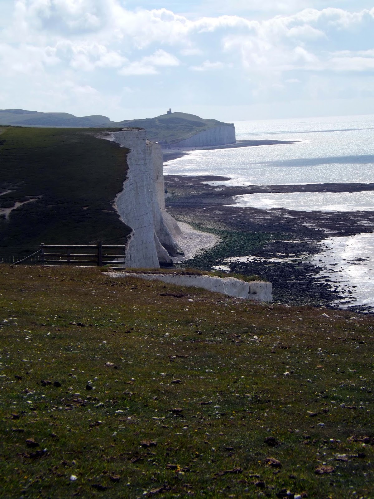
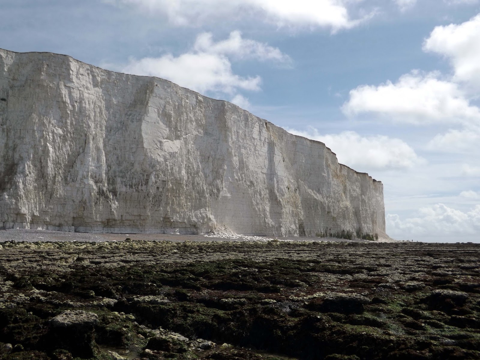
Soon once pass the Lligwy Bay cafe and car park we start to climb up the cliffs above the bay.


Here we get to see the beautiful Anglesey Coast and its crystal clear blue waters.


Along the cliff we come across a sculpture called Bryn Wyfla. A Modern art sculpture, to reflect Anglesey's "history in stone, slate and bronze".


Now as we near Moelfre we pass a island called Ynys Moelfre. Ynys Moelfre is a small island off the coast of Anglesey, Wales. At low tide it has a maximum length of 261 metres and a maximum width of 121 metres with a maximum area of 6.6 acres (27,000 m2). The nearest settlement to the island is the village of Moelfre, and the two are separated by a shallow channel called Y Swnt (The Strait or The Sound), which is never more than 194 metres wide and can at low tide only be waist-deep all the way across. At extreme low Spring tides, it is possible to walk across to the island on dry ground all the way. Due to its proximity to the mainland there are grasses found on the island and a few wild flowers. Species of birds that can be found on the island include gulls, terns, gannets, fulmars, and Great/Arctic skuas. Porpoises are occasionally seen also. There are, however, no man-made structures. It is referred to by some locals as Rat Island.

Ynys Moelfre


Ynys Moelfre


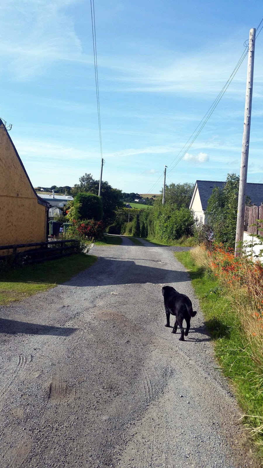
Here my Dog Ben decided he needed a swim and ran off to do so.


We reach Moelfre and pass the Lifeboat Station, we were here on our first day for the annual Moelfre Lifeboat day. Now its much quieter, with no stalls lining the roads and hoards of people.
Moelfre Lifeboat Station has a remarkable history of bravery with its lifeboat crews being awarded 37 medals for gallantry. Two of the Gold Medals were awarded to the outstanding figure in the station's history - Coxswain Richard Evans.


Standing proud above Moelfe and looking out to sea is the Monument to Dic Evans.


This bronze statue of lifeboat hero Richard Evans (1905-2001) was created by sculptor Sam Holland and unveiled by Prince Charles on 23 November 2004. Few lifeboat volunteers are awarded the RNLI’s gold medal for bravery, but he was awarded two.
His father, both his grandfathers and an uncle had already served with Moelfre lifeboat by the time he was born. Dic, as he was known, began sailing on a coastal cargo vessel at the age of 14. He later ran a butcher’s shop in Moelfre and married Nansi, a farmer’s daughter. He became lifeboat coxswain in 1954, on the retirement of his uncle John Matthews.
In 1943 Dic, then second coxswain of Moelfre lifeboat, received a silver medal for his part in the rescue of four airmen who had ditched from an aircraft.
He received a gold medal in 1959 for his part in the rescue of all eight crew from the stricken freighter Hindlea in hurricane-force winds gusting to 104mph. Waves rolled the lifeboat onto its side, putting the mast beneath the water while the ship’s propeller whirled dangerously above the heads of the crew. Despite these difficulties, Dic brought the lifeboat alongside the wreck 10 times to complete the rescue. In 1961 the Queen presented Silver Sea gallantry medals to the crew for this rescue.
Dic was 61 years old when he received his second gold medal for his part in the rescue of the crew of the Greek ship Nafsiporos which was in danger of being wrecked on the Skerries, north of Holyhead. His own son David and Holyhead lifeboat were also involved in the rescue.
In 1969, the year before he retired, Dic received the British Empire Medal. He died on 13 September 2001.


By the Lifeboat shop and cafe is also another Memorial to another sea disaster.
Here The Royal Carter is remembered.

Royal Charter was a steam clipper which was wrecked off the beach of Porth Alerth in Dulas Bay on the north-east coast of Anglesey on 26 October 1859. The precise number of dead is uncertain as the complete passenger list was lost in the wreck although an incomplete list (not including those who boarded just before departure) is retained in the Victorian Archives Centre in, Victoria, Australia. About 450 lives were lost, the highest death toll of any shipwreck on the Welsh coast. It was the most prominent victim among about 200 ships wrecked by the Royal Charter Storm.
 The ship was used on the route from Liverpool to Australia, mainly as a passenger ship although there was room for some cargo. There was room for up to 600 passengers, with luxury accommodation in the first class. She was considered a very fast ship, able to make the passage to Australia via Cape Horn in under 60 days.


In late October 1859 Royal Charter was returning to Liverpool from Melbourne. Her complement of about 371 passengers (with a crew of about 112 and some other company employees), included many gold miners, some of who had struck it rich at the diggings in Australia and were carrying large sums of gold about their persons. A consignment of gold was also being carried as cargo. As she reached the north-western tip of Anglesey on 25 October the barometer was dropping and it was claimed later by some passengers, though not confirmed, that the master, Captain Thomas Taylor, was advised to put into Holyhead harbour for shelter. He decided to continue on to Liverpool however.


The Royal Charter broke up on these rocks near Moelfre

Off Point Lynas the Royal Charter tried to pick up the Liverpool pilot, but the wind had now risen to Storm force 10 on the Beaufort scale and the rapidly rising sea made this impossible. During the night of 25/26 October the wind rose to Hurricane force 12 on the Beaufort Scale in what became known as the "Royal Charter gale". As the wind rose its direction changed from E to NE and then NNE, driving the ship towards the north-east coast of Anglesey. At 11 pm she anchored, but at 1.30 am on the 26th the port anchor chain snapped, followed by the starboard chain an hour later. Despite cutting the masts to reduce the drag of the wind, Royal Charter was driven inshore, with the steam engines unable to make headway against the gale. The ship initially grounded on a sandbank, but in the early morning of the 26th the rising tide drove her on to the rocks at a point just north of Moelfre at Porth Alerth on the north coast of Anglesey. Battered against the rocks by huge waves whipped up by winds of over 100 mph, she quickly broke up.
One member of the crew, Maltese born Guzi Ruggier also known as Joseph Rogers managed to swim ashore with a line, enabling a few people to be rescued, and a few others were able to struggle to shore through the surf. Most of the passengers and crew, a total of over 450 people, died. Many of them were killed by being dashed against the rocks by the waves rather than drowned. Others were said to have drowned, weighed down by the belts of gold they were wearing around their bodies. The survivors, 21 passengers and 18 crew members, were all men, with no women or children saved.
A list of 320 passenger names departing from Melbourne in August 1859 on the Royal Charter is available on-line from the Public Records Office, Victoria: "Index to Outward Passengers to Interstate, UK and Foreign Ports, 1852–1901".
A large quantity of gold was said to have been thrown up on the beach at Porth Alerth, with some families becoming rich overnight. The gold bullion being carried as cargo was insured for £322,000, but the total value of the gold on the ship must have been much higher as many of the passengers had considerable sums in gold, either on their bodies or deposited in the ship's strongroom. Many of the bodies recovered from the sea were buried nearby at St Gallgo's Church, Llanallgo, where the graves and a memorial can still be seen. There is also a memorial on the cliff above the rocks where the ship struck, which is on the Anglesey Coastal Path.
At the time of the disaster there were allegations that local residents were becoming rich from the spoils of the wreck or exploiting grieving relatives of the victims, and the "Moelfre Twenty-Eight" who had been involved in the rescue attempts sent a letter to The Times trying to set the record straight and refute the accusations. The fact that English-speaking press representatives must have encountered a language barrier when attempting to gather information can only have served to further misunderstandings.
Almost exactly a century later (to the day) in October 1959 another ship, the Hindlea, struck the rocks in almost the same spot in another gale. This time there was a different outcome, with the Moelfre lifeboat under its coxswain, Richard Evans, succeeding in saving the crew.


We reached the village and stopped at The Kinmel Arms for a drink. I had a pint of Robinson's Unicorn Ale, a lovely pint too while my son had a coke.

Kinmel Arms, has a great selection of quality real ales, with housing Robinsons award-winning ales; Unicorn, Dizzy Blonde, Wizard, Cwrwr Ddraig Aur and Robinsons Dark Smooth. They also stock Guinness, Carling, Carlsberg, Coors Light, San Miguel, Strongbow and Stowford Press. You will also find an eclectic choice of wines spirits and soft drinks.


After our refreshments we walked back along the same route we took out.


Moelfre Village
The meaning of the Welsh language word ‘Moelfre’, translated into English, is 'bald or barren hill', which describes the land behind Moelfre village, as seen from the sea.

 On July 30th, 1862, the screw sloop Enrica, soon to be commissioned as the Confederate States of America warship CSS Alabama sheltered in Moelfre Bay while evading both British customs authorities and the USS Tuscarora, which had been sent to capture or sink her.  There were no street lights in the village until well after the Second World War. Moelfre RNLI Lifeboat Station has a distinguished history, including the Hindlea rescue in 1959, when all the crew were rescued. There has been a lifeboat in Moelfre since 1854.


Just before we reached the Lifeboat station, I couldn't believe my eyes. A Razorbill was just sitting on the rocks totally ignoring all the foot traffic above.

A Razorbill on the rocks


Further on we reached a bay with a stony beach, where we decided was a good spot for a bit of swimming.


After drying off we walked on back the way we came and eventually back to the Minffordd Caravan park after a lovely 6 mile walk. The furthest my son has walked, so was particularly proud of him.


The Minffordd Caravan Park is somewhere I'd recommend if you want to stay in the area. An immaculate kept park and caravans with friendly owners.

Monday 31 July 2017

Jevington, Seven Sisters Circular walk 31st July 2107

On Monday the 31st of July 2017 I set off from home early at about 7am to make my way to Jevington in East Sussex. I arrived about an hour and three quarters later and parked up in the free car park(Postcode BN26 5QB).
I decided to more or less follow this route; http://fancyfreewalks.org/E.Sussex/SevenSisters.pdf


From the car park I walk straight out onto the footpath that will take me to Friston Forest.

This path takes an immediate uphill direction, a great way to start the walk, looking back across the hills and valleys.


Looking back down the hill.
I now enter Friston Forest. Most of the forest was planted with Beech in the 1950s, in places with conifers to help young broadleaf trees to develop. Gradually many of the conifers have been removed to leave large areas of beech.

The forest was alive with birds, butterflies and lovely wild flowers.


An opening in the forest looking over the hills beyond.


I now reach West Dean, where I leave the forest behind.


West Dean in East Sussex is one of those villages only read about in books, it is hidden just off the Seaford to Eastbourne coast road. West Dean was originally known as Eorlscourt, later to be Earlscourt then Dene and finally West Dean.


The village was probably founded in Saxon times as a fishing and salt producing village hidden away from the weather by the valleys. It is known that Alfred the Great had a palace in the village, and it is possible that this was one of his naval main bases , in his war with the Vikings .

After the Norman Conquest in 1066 the village was given to Earl Mortain , King Williams half brother. He gave the land together with nearby Exceat to the Monastery of Grestein, and their nearby priory at Wilmington .


During the 1100's the area was important as West Dean and Exceat paid more in taxes than nearby Lewes , the villages were probably associated with Seaford in their ties with the Cinque Ports .

In 1305 King Edward I who was at nearby Lewes visited the villages implying a still great importance in the history of the Realm, again probably naval power.


The Black Death and subsequent French raids affected the village quite badly and nearby Exceat was abandoned by the 1450's.

The area was used by the smugglers in the 1800's , as the Alfriston gang led by Stanton Collins roamed the local villages, this was to stop in 1831 when he was arrested and deported for 7 years.


I walk up to All Saints Church. Dedicated to All Saints, West Dean church is also the most ancient in the Cuckmere Valley, showing traces of Saxon origin. The unusually squat gabled spire has been likened to a monk's cowl, with the small windows in the tower giving the appearance of a face.


Inside, apart from the beautiful Norman arch to the tower, the prevalence of Early English work indicated that the church may have been extensively re-ordered when Sir John Heringod was Lord of the Manor in the early part of the 14th century. There is also an ornate stone tomb to William Thomas and his wife who bought the Manor of West Dean in 1611.

The Old Parsonage next to the church is the oldest priest's house in England still in occupation.

The Old Parsonage


The Old Parsonage

I walk back through this very pretty village to head on with the walk. 


Dovecote
The 14th century Dovecote was conserved in 2010 using local Wadhurst clay tiles, Hever woods oak and North Downs chalk. It is now an RSPB site for Barn Owls with robins and bats at present. It forms part of the medieval settlement of Westdean House, taken down in 1825 except for parts of the east and south walls and part of a Jacobean banqueting house.


I reach a t junction now with signs marking the South Downs Way, but which way? I take the path to my left and walk up a small way before deciding this isnt right and I back track and head up the steep steps before me to Exceat and Cuckmere Haven.


Once at the top of the hill, I reach an opening and my first view down to Cuckmere Haven and its meandering river down to the sea.


I walk down into Exceat and cross the busy A259 road.  To my right is the Golden Galleon pub but its far too early for a drink.
The remote shingle beach at nearby Cuckmere Haven has seen many a smuggling run. In the Middle Ages, Seaford was one of the main ports serving Southern England, but the town's fortunes declined due to coastal sedimentation silting up its harbour and persistent raids by French pirates. Between 1350 and 1550, the French burned down the town several times.

I decide upon on taking The South Downs Path uphill instead of staying low and following The Cuckmere River.

In the Second World War, the site was studied by the Luftwaffe as they flew missions to identify potential landing sites for the invasion of the UK mainland. As a result, the British constructed a series of counter-landing defences, of which numerous pillboxes, anti-tank obstacles, ditches and tank traps survive. Admiralty scaffolding blocked the inlet, but is now gone. Cuckmere Haven featured heavily in the war effort: at night lights were placed to confuse bombers into thinking they were above Newhaven and an airfield was set up further inland. In addition to the permanent land-based constructions, the river was heavily mined.


Coastguard Cottages
The Coastguard Cottages at Cuckmere Haven were built shortly after the National Coastguard Service was founded in 1822. Prior to this Cuckmere Haven was an important place for smuggling. The cliff face in front of the Cottages has since retreated by more than 30 metres due to Coastal erosion. This combined with the loss of shingle from the beach below the cottages due to wave action in storms has put the Cottages in danger. A fundraising campaign has been created to protect these iconic buildings.


I walk through the above gate and it seems I now head back down to the river. Might as well stayed down there in the first place  !!


I walk along the river before taking another path that heads back up the hill and onwards .


I am now leaving Cuckmere Haven behind me as I steadily climb upwards. 

Heading to Birling Gap and Belle Tout lighthouse can be seen in the distance

The terrain is undulating and rather strenuous with all the up and downs, but what amazing views"


I stopped briefly to eat some lunch whilst I took in the views,smelt the salty sea air and listen to the waves crash in. Bliss !


A Stonechat


I reach Crowlink. Crowlink is an isolated village a short way off my route.


A Red-Tailed bumblebee


After many more up and downs, I reach an monument atop a hill. 

At Flagstaff Point , I saw a Sarcen Stone, set on top of a square bench.  Sarcen stones are particular to the south coast of England.  Around 40 to 60 million years ago,  sediment formed by sand and silt became covered in groundwater which was rich in silica.  Over time, the intensity of the silica increased, until the water could no longer hold it as part of a liquid solution.  The silica solidified and filled the gaps between the sand, acting as glue to form a two metre thick band of rock across southern England.  During the last 3 million years, and particularly during the last ice age, freeze-thaw cycles and water erosion broke this layer of sarcen up into boulders, leaving millions of them scattered across the landscape.  Some have been put to good use.  Go and have a look at Stonehenge if you don’t believe me.
As for the Sarsen Stone at Flagstaff Point, it probably feels very much at home.  The Seven Sisters were, after all, carved out of the rock by the erosion of glacial melt water.


I walked on, enjoying the sunshine. It had been raining on the drive up and I was worried as no rain had been forecast and I didn't it ruining my walk. But now the weather couldn't be better.


One of many yachts out on the crystal blue waters.

It is sometimes said that the Seven Sisters got their name because the land used to be owned by seven sisters.  I reach an monument in the name of Michel Dene.  The plaque states that Michel Dene was bequeathed to the National Trust by W A R Robertson, in memory of two of his brothers who were killed in the First World War.


I stopped to have a drink and re-arrange some chalk artwork in my wifes and I initials .

Now I finally reach Birling Gap after much walking. Birling Gap is a beautiful and tranquil enclosed pebble beach set below the dramatic backdrop of the Seven Sisters cliffs.

Birling Gap is managed by The National Trust and there is a delightful Tea-room here. However tea wasn't the first thing on my mind, I wanted to get down to the sea.


I am surprised to see these empty houses still haven't slipped away into the sea since my last visit some years ago.

I took the metal stairs down three flights (or was it four?) to the stoney beach. The beach was filled with young kids I assumed had travelled up by coach and didnt want to walk more than a few feet from the stairs.

Saw I walked on up the beach and found a small alcove in the cliff, where I could get changed in behind a towel out of sight.


As I usually try to do, if there is a body of water to be swam in on a walk. Im in !


So In I got, the water was surprisingly warm. But as it wasn't high tide it was shallow and I had to navigate the rocks.


I now made my way back to shore and back up the stairs.


I back tracked a bit and took a path heading up to East Dean.

Belle Tout Lighthouse.
Belle Tout is a former lighthouse that first entered service in 1828, over 130 years after the need for one was first suggested. It had 30 oil lamps, requiring two gallons of oil per hour. A problem with the lighthouse’s location soon became apparent, however – when the weather was bad, the cliff top tended to be shrouded in mist, so the light could not be seen. The cliff also blocked the view of the light from ships sailing too close to the shore.
As a result, a new lighthouse was built – the one that still stands at the base of Beachy Head to this day. It opened in 1902, and Belle Tout went out of commission. It was a tea room for a while, accidentally damaged by Canadian artillery during World War II, and later restored by the local council.
By the 1990s Belle Tout was a private house and in danger of falling into the sea due to cliff erosion, and so in March 1999 in a feat of engineering that captured national media attention, it was moved back 17 metres away from the cliff using hydraulic jacks. It was then bought by a preservation trust and in March 2010 started a new life as a luxury bed and breakfast, with the lantern room turned into a lounge with 360 degree views.

I head on up a hill and looking back with fabulous views across the Seven Sisters.


I now approach East Dean and look down upon it from the top of the hill.


I take a off path tour of this delightful village another gem of a village to rival West Dean I feel.


I walk across to the pretty village green.

Here is a house where it seems Sherlock Holmes saw out his last days as a bee keeper.
Or did he? read more here

Here too is a plaque commemorated to the remains of The Beach Head Woman.

It is unprecedented to find human remains from Sub-Saharan Africa in our area. From various pieces of recent scientific evidence we understand that she was born locally, or at least lived here from an early age.  Further research revealed that in 1891 three bodies were unearthed in a Roman cemetery, west of Beachy Head in East Dean.  One of the skeletons was wearing copper bangles which were kept in the museum, but were subsequently destroyed during the bombing in the war.  Could one of these have been our carefully interred ‘Beachy Head lady’ – if so, a lady of some standing?  The discovery of the likely site of this cemetery could soon throw more light on our lady’s origins.


It isn't hard to see why East Dean has been awarded 'Best Kept Village in East Sussex' for many years.

I pass by The Tiger Inn on the green.The Tiger Inn has been serving fine ales, wines and food to surrounding residents, farmers, soldiers, walkers, smugglers, lovers and brewers since the 16th century.
I walk on to head down the hill to see the church.


The church in East Dean, dedicated to St Simon and St Jude, has a Saxon tower and an unusual Tapsel gate (preventing cattle from entering the churchyard); that at Friston is dedicated to St Mary the Virgin.The churches have formed a united benefice since 1688. The latter contains Tudor monuments to the local family Selwyn and the grave of the composer Frank Bridge (1879–1941).


I head out along the road and pass another free car park, should you wish to start the walk from here instead.


Even the Bus Stops are immaculate.

I cross the busy road and head up through a pretty housing estate up a steep hill to the top.


Here at the top of the hill, I turn right and walk along a bridle path that leads out into a field. Here there is a sign post, one pointing towards Beach Head, But I walk straight on forwards up the hill heading back towards Jevington.


After much walking through pretty fields, I reach a cross Road where I take the left turn down towards Alfiston, but I will of course be stopping at Jevington.

A Trig-point


St Andrews Church,Jevington


I descend down the steep path towards Jevington passing wheezing cyclists going up.

Jevington means ‘homestead of the people of Geoffa’.

I reach Jevington.Here is the Hungry Monk Cottages that lay to claim fame of the birth place of the Banoffi Pie.


Credit for the pie's invention is claimed by Nigel Mackenzie and Ian Dowding, the owner and chef, respectively, of The Hungry Monk Restaurant in Jevington, East Sussex. They claim to have developed the dessert in 1971 by amending an unreliable American recipe for "Blum’s Coffee Toffee Pie" with a soft toffee made by boiling an unopened can of condensed milk for several hours. After trying various changes including the addition of apple or mandarin orange, Mackenzie suggested banana and Dowding later said that "straight away we knew we had got it right". Mackenzie suggested the name "Banoffi Pie", and the dish proved so popular with their customers that they "couldn't take it off" the menu.

 Sadly though it is now closed and has been turned into cottages.

I walk up a road to reach St Andrews Church. Set within the South Downs, contains medieval architecture with interesting features. The Saxon tower, built of flint and local sandstone, dates from 900AD.


I now walk back to the car after a 15 mile delightful walk. A real gem of a walk,so glad I found it !