On Tuesday the 29th of August 2017 My son and I set off for Bewl Water and after just over an hour we arrived and parked up.
Parking at Bewl Water costs just £2 per car for the entire day. Gates open at 8am and close 30 minutes before sunset.


It was as early as 1946 that the idea was conceived to build a
reservoir to serve the Medway towns along with other parts of Kent and
East Sussex. However it wasn’t until the 1960s that plans for this new
source of drinking water began to gather pace and attention came to rest
on the Bewl Valley between Lamberhurst and Ticehurst.
In the years immediately following the Second World War it was
realised that the growing population in the South East of England would
not be able to rely on traditional underground supplies of water
forever. Instead it was decided that harnessing and storing surface
water for times of need would be an invaluable investment for the
future. Architects, planners and engineers wanted somewhere close enough
to the target area to be practical yet at the same time avoid
large-scale disruption.
The Bewl Valley seemed to be the perfect choice as it would not
affect any major road or rail lines and there were very few people
living in the immediate vicinity that would be affected. Furthermore,
two major materials necessary for building the dam were available
locally. These were clay, ideal for retaining water, and sandstone, both
of which could be dug out of the ground nearby thus saving the cost of
importing them.
The Queen gave Royal Assent to what was known as the Medway Water Act
on 26th July 1968. This was the green light for work at Bewl and the
project began in 1973.

A 900 metre long dam was constructed across the valley from clay
excavated from the ground. This was strengthened with blocks of
sandstone. The bank of the dam was covered in twelve inches of gravel
underneath a layer of five inch concrete slabs to protect it from
erosion. Pipes were built underneath the dam to enable the river Bewl to
continue flowing.
Two large concrete towers were installed. The taller of the two was
designed to draw off water when needed. The other was the overflow which
was built to prevent the reservoir from getting too full.

We make our way around the reservoir and stop to take some pictures of the concrete towers.

Many recreational activities take place on and around the reservoir. These include sailing and windsurfing (formerly through Bewl Valley Sailing Club,
now through Bewl Sailing Association Ltd), rowing and sculling (through
Bewl Bridge Rowing Club), Canoeing and Kayaking (through Bewl Canoe
Club), trout fishing, walking and cycling (on a 12½ mile Round Reservoir
Route).
Bewl Water Outdoor Centre offers a wide range of training, team building and adventure opportunities, on and around Bewl Water.
There is also a passenger boat and a restaurant, conference facility and gift shop.

The project was completed by the end of 1975 and when full, Bewl
Water can hold up to 31 million litres of water and covers about 770
acres of land.
In 2004 work was completed on a pipeline connecting Bewl Water with
Darwell Reservoir near Robertsbridge. At a cost of £25 million the 17km
long stretch of piping was installed to help resupply this area of East
Sussex during times of drought.


A walk beside the beautiful waterside, contrasted by walks into wooded areas by the water.


Across Bewl water we can see some Oasthouses.
RSA gained planning permission for the conversion of the oast house near Ticehurst to a detached five bedroom dwelling.
The oast house is situated near to Bewl Water with extensive views across the water. The clients required a high level of internal finishes and oak was specified extensively for the flooring and joinery including the staircase.

We leave Bewl Water and head up past a farm to a road, here we turn left along a road until we turn right onto a footpath. We however walk past the path a little way as the entrance and sign is concealed by the overgrown hedge. We take this path diagonally across a field and past a caravan site, to the busy A21.
 |
| The A21 |
After carefully dashing across the A21,we take a path opposite towards Combwell Priory Farm. Here was a sign saying "Dogs on the loose". My son was a little worried, but I re-assured him and we walked on up the path. (There wasn't any loose dogs).


After walking through longish wet grass, our shoes and sock were a little damp.

After walking through the fields, we past a pond and enter Cats Wood.


The woods were dense and full of ferns. It was like a scene from Jurassic Park.
It was eerily quiet,almost no bird song at all!


We miss a turn for the footpath diversion and end up on a road that ran parallel, so we follow this into Kilndown.


Along the road there were hops growing amongst the hedgerow.

Kilndown was established in the 1840s by Viscount Beresford. William Carr Beresford, First Viscount Beresford, British general and politician, died here on 8 January 1856 at age 85.

Kilndown first appears on Hasted's map in 1778 but was referenced as
"Killdown"; the "Kiln" in the current name may have come from the kiln
oasts harvested in the area, or that the area produced bricks.
Two estates existed near the village: the first was the Combwell Estate that was formed during the reign of King Henry II, however it became a priory in 1220. However the priory was destroyed during the Reformation of the Church in the 16th century. Nothing of the building remains.
The Bedgebury Estate was mentioned in a 814 charter and was a known
home to the Culpeper family in the 16th century and the estate contained
two Iron Furnaces to help defeat the Spanish Armada in 1588. William Carr Beresford,
or Viscount Beresford, purchased the estate in 1834. This led to
development on the estate and Christ Church was built. This led to
numerous shops, craftsmen and a public house, which still remains today:
The Globe and Rainbow.

Christ Church, Kilndown was built in 1841. It is built in a unique Gothic revival style.

The Church was built by one of the Duke of Wellington’s generals from
the Napoleonic Wars, Field Marshal Viscount Beresford. Beresford had
purchased the nearby 2,300 acre Bedgebury Park estate in 1836 and the
church was built as a chapel of ease for the area of Goudhurst. It was
consecrated in 1841 and in 1843 Kilndown became a separate parish.


One of the most remarkable gems, just inside the church, are the
free-standing marquetry panels known as The Bedgebury Panels. The
Bedgebury Park estate had its own workshop including a sawpit. The
workshop produced high quality examples of marquetry. In the 1860’s
marquetry was known as Tarsia or Intarsia, a craft that originated from
Italy. Records are not clear as to where exactly the skill of marquetry
was learnt by the Bedgebury craftsmen. However, between 1865 and 1881
the workshops on the estate were dedicated to perfecting its
complexities and George Parks was their lead craftsman.

The panels were originally created in the mid 1870s for the chapel at
Trinity College, Cambridge. They were removed from there in the 20th
century to make way for a memorial to the fallen in the Great War. The
abandoned panels were found gathering dust in a cupboard beneath a set
of stone stairs. It was suggested that the panels be returned to the
parish in which they were made and be placed in the church at Kilndown,
which is where they remain today, on permanent loan. The panels
underwent restoration in 1986.

Each of the panels contains a medallion head of a Biblical character,
surrounded by arabesques, flowers (including: buttercups, daisies,
daffodils, fox gloves, water lilies and violets), fruit and birds
(including: a green woodpecker, barn owl, finches, wagtails and
kingfishers).
The Synagoga depicts four leaders of the Hebrew nation, all of
which are from the Old Testament: Levi, Judah, Joseph and Benjamin.

After leaving the church we passed the vicarage below and walked on down the road.
 |
| The Vicarage |

George had started to complain that he feet are hurting now. We stop at a bus-stop for a short rest.

 |
| George waiting for a bus |
We walk a little way past the bus stop and take the path through an area of open ground and woods made of pine trees.

Here we met a man called Andrew and his dog 'Mash'. Apparently he had another dog called 'Pie' that had passed. He advised of the best path to take to head over to Scotney Castle. After walking with us for a bit we parted ways and we head uphill to a farm track.


We follow the road for a way before we arrive at Scotney House and Scotney Castle.
The house was built by Edward Hussey III from the sandstone quarried
from the grounds of the Old Castle. It is positioned to overlook the
Castle and estate and the garden was also designed and created at the
same time. This meant that all the three elements: house, garden and
estate would work as one in creating a perfect picturesque country home.

The wood panelling and some of the significant furniture was also
designed specifically for the house by Salvin which gives a lovely flow
of continuity to the home. However the Hussey family were great
collectors and hoarders of everything so you will see many influences
from different generations as you walk around.

At the top of the garden stands a house which was built to replace the
Old Castle between 1835 and 1843. This is known as Scotney New Castle,
or simply Scotney Castle, and was designed by Anthony Salvin. It is an early, and unusually restrained, example of Tudor Revival architectural style
in 19th century Britain. Following the death of the resident, Elizabeth
Hussey, in 2006, this house was opened to the public for the first time
on 6 June 2007.


After visiting the reception, it became apparent we needed to book a time to visit the house. Time being in short supply, we decided to forgo the house and head straight down to the castle. But not before having an ice-cream, today was one hot day !
 |
| Scotney Castle appearing amongst the trees as we walk down |
We walk on down through the gardens. Scotney Castle’s garden is like a landscape painting with drama and
romance. From a stunning vista of the Old Castle glimpsed through a
swathe of rhododendrons and azaleas in spring to colourful reflections
in the moat throughout autumn.

The garden has naturalistic planting which is seemingly untouched by
human hand and its cloud-like planting of rhododendrons and azaleas
creates a fairytale feel, with the ruins of the Old Castle at its
centre. Wisteria and old English roses adorn its sandstone walls, whilst
the surrounding herbaceous beds are always throwing out new colours
throughout the seasons.

The earliest record from 1137 gives the owner of the estate as
Lambert de Scoteni. Roger Ashburnham is credited with building the castle c.1378–80.
Construction of the castle began as a roughly rectangular fortified
house with towers in each corner. The original plan may never have been
finished, and by 1558 it is likely only the southern tower remained. In
1580 the south wing was rebuilt in Elizabethan architecture style, and around 1630 the eastern range was rebuilt in three-story Inigo Jones
style. The Elizabethan wing remained a bailiff's residence until 1905,
but the eastern range was partly dismantled on the completion of the new
house in 1843, leaving the ruin as a garden feature.

Catholic Recusant owner Thomas Darrell hid Jesuit Father Richard Blount, S.J. in the castle while he ministered to Roman Catholics
from 1591 to 1598. Catholicism was then illegal in England, and during
the second raid by authorities to arrest the Father he fled over a wall
into the moat and escaped.
The Darrell family owned the estate for some 350 years. In 1778
Edward Hussey bought the estate and his grandson, also Edward, built the
'new' Castle to the designs of Anthony Salvin,
from sandstone quarried from the slope below. The hollow created was
developed into a Quarry Garden and contains a 100-million-year-old
impression of a dinosaur's footprint.

On Christopher Hussey's
death in 1970 the estate was left to the National Trust. Several
apartments in the castle and on the estate were let out by the Trust,
with tenants including Prime Minister Margaret Thatcher
who rented the Belfry flat for a time during the 1970s and 1980s, when
it served as a weekend escape for her from Westminster life.

The castle grounds have played host to Shakespeare productions, notably A Midsummer Night's Dream, with the actors appearing from behind the bushes on cue.
Old Scotney Castle was used as the location for the video to the Squeeze song Some Fantastic Place.


 |
| Shoal of Roach in the moat |


 |
| George relaxing in the living room |


After five years at the English College in Rome, Blount was ordained a priest in 1589. He worked with Father Robert Parsons, S.J.
to smuggle himself back into England in 1591 posing as returning sailor
prisoners-of-war from the failed expedition against Spain by the Earl of Essex. He was taken before the Lord High Admiral Howard of Effingham
to present his story. His knowledge of the events and of seamanship
were good enough for him to pass and be allowed back into England.
He worked as a priest from hiding in Scotney Castle.
He entered the Society of Jesus and became a Jesuit on 5 May 1608 by taking the four vows of the Order.
In 1617, Blount was selected as Superior
of the English mission of the Society. As Superior he took on the yoke
of leadership of the English Jesuits. At the time there were
approximately 200 Jesuits, 109 of which were in hiding in England.
In 1619, the Pope made England a trial province. Identification as a
province indicated that the area covered had stability and permanence.
Blount was appointed to the highest leadership position in a trial
province, Vice-Provincial. Blount's task as Vice-Provincial was to
organise the province for further validation at the next meeting of the Society of Jesus leadership. Blount organised five fictional colleges in London, Lancashire, Suffolk, Leicestershire and Wales.
His work was recognised by the Order leadership and England was made a full Province of the Society with Blount as the first Provincial superior.
Blount was the Provincial of the English Province of the Society of
Jesus until 11 August 1635, when he was succeeded by Henry More, S.J.
Father Blount hid in the priest hole below.


 |
| The Boat-house |
We pass the Grade II listed boat-house built 1838.


Crossing the bridge we view Scotney Castle from the opposite side of the moat.


We walk back up past the house and on to the Walled Garden at Scotney Castle.


We leave the Castle grounds and after a bit of map searching, I find the path we need to make our way back to Bewl Water. George is very tired and hot now, so I am looking for a way to shorten the walk.

So we eventually meet the A21 and with no walkways alongside this, it wasn't possible to walk along it.
We met another family looking for a short way to get back to Bewl Water. We all cross the A21 into the wood opposite.
Here it was very overgrown with nettles and brambles, we made our way through and up to a fenced off area that we had to navigate our way around, scaring away the many pheasants here. There was evidence that this was a wood used for the purpose of shooting.
We eventually find our way out of the wood and see a sign saying 'No Entry. Private Wood' whoops, too late now.
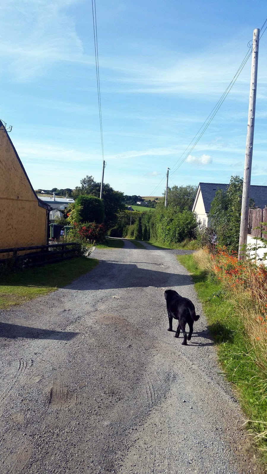
We walk along Bewlbridge Lane and back to the car park, George was knackered and never been so happy to see the car.

After a 13 mile walk we had completed the walk, the second walk George had completed and the longest ! Well done George.

GPX File here.............. http://www.haroldstreet.org.uk/routes/download/?walk=3096