GPX File Here.
On Thursday the 14th March 2024 I drove the hour and a half to Staines on Thames and found free street parking on Richmond Road TW18 2BY. I parked up pulled on my boots and walked back down to where I left off last time almost a year ago!
i

I join the riverside and walk under the railway bridge.

I pass the statue of the Swan Master statue moved here in 2014.
Royal Swan Upping plays an important role in the conservation of the mute swan and involves The King’s Swan Warden collecting data, assessing the health of young cygnets and examining them for any injuries. Cygnets are extremely vulnerable at this early stage in their development and Swan Upping affords an opportunity to help both adults and cygnets that might otherwise go untreated.
The Royal Swan Uppers, who wear the scarlet uniform of His Majesty The King, travel in traditional rowing skiffs together with Swan Uppers from the Vintners’ and Dyers’ livery companies. Many schools are invited to meet the Swan Uppers on their journey up river. The children involved may have the opportunity to view cygnets at close quarters and ask questions about swans, the boats used and The King’s ownership of mute swans. The participation of school children is a positive element of Swan Upping and their enthusiasm for wildlife is always to be encouraged.

Almost immediately pass the Swan Master is the London Stone.
London Stone is the name given to a number of boundary stones that stand beside the rivers Thames and Medway, which formerly marked the limits of jurisdiction (riparian water rights) of the City of London.

Until 1350, the English Crown held the right to fish the rivers of England and charged duties on those people it licensed to fish. In 1197 King Richard I, in need of money to finance his involvement in the Third Crusade, sold the rights over the lower reaches of the River Thames to the City of London. Marker stones were erected to indicate the limit of the City's rights.
In Victorian times, the Lord Mayor would come in procession by water and touch the Staines stone with a sword to re-affirm the City's rights.
Control of the river passed from the City to the Thames Conservancy, and then below Teddington to the Port of London Authority and above it to Thames Water Authority and finally the Environment Agency.
In medieval times before the canalisation of the Thames, Staines, was the highest point at which the high tide was perceivable for a few minutes every semi-diurnal tide (twice a day), adding some millimetres to the water depth compared to more upstream parishes. This London Stone marked the upstream limit of the City's rights. The official role of a Corporation of London stone of 1285 beside Staines Bridge was set out with a grant of associated privileges in a charter of Edward I. Its use by the river is indicated by the indentations (on the right-hand face in the photo), caused by tow ropes of horse-drawn boats rubbing against the stone.
In 1986 the stone was moved to the Old Town Hall Arts Centre, Market Square and a replica was placed in the Pleasure Ground.
In 2004 the original was moved to Spelthorne Museum, Spelthorne Library, Friends Walk/Thames Street.

I walk on crossing Staines Bridge to the South Bank.

The fifth and present Staines Bridge with three arches in white granite, was designed by Sir John and George Rennie. Construction started in 1827, and it was opened in 1832, by King William IV and Queen Adelaide. This bridge crosses the Thames on the reach between Penton Hook Lock and Bell Weir Lock, and is close to and upstream of the main mouth of the River Colne, a tributary. The crossing carries the Thames Path across the river. Tolls were abolished in 1871. The City of London ‘city limits ’Coal tax markers are still in place on today’s bridge, which is Grade 11 listed. In the town Clarence Street was constructed at the same time, and many buildings remain to this day.

Across the river is Holm Island. With a modern building that hides Hollyhock Island which until the 1930's had a small house called 'The Nest' alleged to be a hideaway for King Edward VIII and Mrs Simpson.

I walk along the South Bank admiring the expensive looking riverside properties.


I walk so far and the path is blocked by a damaged bridge. I tried to see if there was a way to gain access to the bridge, but it was impossible. So sadly I had to backtrack almost as far as Staines Bridge. I find a way through a retail park and out onto The Causeway.

I walk under the M25 bridge and turn right to re-join the river.


I pass the Runnymede Hotel and continue my way along the river.

I walk pass Bell Weir Lock.Bell Weir Lock is a lock on the River Thames in England by the right bank, Runnymede which is a water meadow associated with Egham of importance for the constitutional Magna Carta. It is upstream of the terrace of a hotel and the a bridge designed by Edwin Lutyens who designed an ornamental park gate house along the reach. The bridge has been widened and carries the M25 and A30 road across the river in a single span. The lock was first built by the Thames Navigation Commission in 1817; it has one weir which is upstream. The lock is the eighth lowest of forty-five on the river and is named after the founder of the forerunner of the adjoining hotel who took charge of the lock and weir on its construction.

A proposed location for a pound lock (impounded water as opposed to a flash lock) in 1811 was across the next bend upstream. The lock and embankments were built at its present site in the winter of 1817–1818. It was known as Egham Lock, but took its name from Charles "Charlie" Bell who founded in the 18th century an inn by the site, The Anglers Retreat, which he continued to operate when entrusted with keeping the lock and weir. The weir collapsed under weight of ice in 1827, so too the lock in 1866. Lock and weir were rebuilt in 1867. The lock had to be rebuilt in stone in 1877. A new weir was completed in 1904.

Across the river is the Hythe End river water extraction facility. This was built in 1910 to supply water from the River Thames to its works in Ashford Common via the Staines Aqueduct and feeds the King George VI Reservoir.

 |
The Hythe End river water extraction facility (1910) |


I walk on passing the Runnymede Boatyard.


I pass the Wraysbury Skiff and Punting Club as I follow the path.


There are lots of Mistletoe in the trees here.
 |
| Mistletoe |

I pass a pair of Egyptian Geese and their youngsters with Dad keeping lookout from a bench.


I reach the Runnymeade Pleasure Ground.

A statue of Queen Elizabeth II was unveiled at Runnymede as part of the Magna Carta 800 year celebrations on the 14th June 2015 attended by the Queen herself and the Parliament Speaker Rt Hon John Bercow MP.

Not the best statue of our late Queen I've seen!


I follow on the path, trying to find out where the Magna Carta Monument is off to my left somewhere off the path as I didn't want to miss this!


On the far bank is the ruins of Ankerwcke's Priory.

Ankerwycke Priory was a priory of Benedictine nuns in Buckinghamshire. It was established around 1160 and dissolved in 1536. Excavations were carried out at the priory in 2022.

On my far left up on top of the hill is the Runnymede Air Forces Memorial.
The Air Forces Memorial at Runnymede commemorates by name over 20,000 men and women of the air forces, who were lost in the Second World War during operations from bases in the United Kingdom and North and Western Europe, and who have no known graves. They served in Bomber, Fighter, Coastal, Transport, Flying Training and Maintenance Commands, and came from all parts of the Commonwealth. Some were from countries in continental Europe which had been overrun but whose airmen continued to fight in the ranks of the Royal Air Force.
The memorial was designed by Sir Edward Maufe with sculpture by Vernon Hill. The engraved glass and painted ceilings were designed by John Hutton and the poem engraved on the gallery window was written by Paul H Scott. The Memorial was unveiled by The Queen on 17 October 1953.

I leave the riverbank crossing the road I make my way across a waterlogged field to see the Magna Carta Memorial.

Runnymede’s most famous role in history is as the site of the sealing of the Magna Carta, the ‘Great Charter of Freedoms’.
Sealed in 1215 by King John, the Magna Carta aimed to bring England’s sovereigns under the rule of law and was the foundation for the country’s legal system.


In 1215, England was in political turmoil. King John had become hugely unpopular, thanks to a feud with the Church, a reputation for cruelty and connivance, and a costly ongoing war with France that led to him raising taxes for his Barons, the country’s major landowners.
An alliance of rebel Barons had tried for years to curb John's cruelty. In early 1215 they took control of London, leaving the King no choice but to negotiate in order to avoid civil war.
On 15 June 1215, King John met the Barons at Runnymede and finally signed – or, more accurately, put his seal to – the Magna Carta.

The Magna Carta required England’s sovereigns to obey the law, just as their subjects must.
A total of 63 clauses protected the freedom of the Church, prevented the king from levying taxes without discussion and ensured legal protection – at least for some – against an otherwise tyrannical ruler.
The most famous and important of these clauses enshrined the right of ‘free men’ to justice and a fair trial.
Although ‘free men’ at this time only referred to powerful landowners like the Barons, and members of trade guilds, this passage has acquired symbolic significance over the years.
Today, it is one of three original clauses of the Magna Carta that are still preserved in British law.

By the end of May the King had retreated to his fortress at Windsor Castle, so the Barons rode out to meet him, setting up camp on the north side of the River Thames at Staines.
We know from 13th century sources that the field of Runnymede had been used for outdoor council meetings since ancient times.
It was also halfway between the two camps, and was bounded by the Thames to the north and Cooper’s Hill to the south, making a surprise attack unlikely.

I make my way back out from the Magna Carta Memorial, negotiate a waterlogged field again to see the JFK memorial next door.

Runnymede's symbolic significance in the story of democracy meant that it was chosen as the site of UK's memorial to President John F. Kennedy following his assassination. On 14 May 1965, Her Majesty was joined by President Kennedy’s widow, Jackie, and their two children to inaugurate the memorial. During her speech, The Queen formally bequeathed the acre of land on which the Portland stone cupola is set to the United States.

Back down into the waterlogged field I make my way across to firmer ground to see The Jurors at Runnymede.

Twelve intricately worked bronze chairs stand together on the ancient meadow at Runnymede, created by artist Hew Locke to examine the changing and ongoing significance of Magna Carta. The Jurors is not a memorial, but an invitation to sit down and reflect upon the histories depicted in the artwork.
Each bronze chair incorporates a main image on the front and back, representing key moments in the struggle for freedom around the world, and is embellished with flowers, keys and other significant symbols. The artist has coloured and polished some areas, as well as adding slashes and gouges to the surfaces. The result is a rich layering of imagery, marks and textures.
If you’re visiting The Jurors, listen to the audio guide presented by National Trust curator, Rowena Willard-Wright with the artist, Hew Locke, and discover the inspiration behind the artwork.


I pass some willow sculptures as I approach the NT tearoom at Runnymede.

I see a set of willow sculptures called Haymaking. The scene comprises 19 separate pieces of sculpture made from willow and includes picnickers, field workers, gleaners, a haystack and even a full-sized horse.

I cross the road by the NT tearoom and re-join the Thames Path along the riverside again.


The path now takes me into Old Windsor.


The name originates from old English Windles-ore, Windlesora, or winch by the riverside.The village was originally called Windsor, until the (now larger) town of "New" Windsor, 3 miles (5 km) from the village, and grew up next to Windsor Castle, assumed the name. Windsor is first mentioned in the Anglo-Saxon Chronicle.

Old Windsor was once the site of an important palace of the Saxon Kings. The settlement is documented as a defended royal manor in Edward the Confessor's time, but archaeological evidence suggests royal connections had existed since at least the 9th century. The Saxon royal site was excavated between 1953 and 1958, and the finds are at Reading Museum. Edward gave the manor to the Abbot of Westminster in 1066, but it was soon taken back into royal possession by William the Conqueror.

Old Windsor was popular with the monarch because of its convenient location; near to the River Thames for transport and Windsor Forest for hunting. Old Windsor was also an early minster location and market, probably associated with a lock, and important riverside mill complex. The Saxon palace was eventually superseded by the Norman Windsor Castle, at 'New' Windsor. The palace, however, became a popular royal hunting lodge while Windsor Castle was still a fortress rather than a comfortable residence.

Old Windsor is, or has been, the home of several famous people, including:Sir Elton John, who lives at Woodside on the edge of the Great Park.
Actress Geraldine McEwan, who was born in Old Windsor.


I reach the Old Windsor Lock.

The old name for the site of the lock was "Top of Caps" and the first suggestion for a lock at "Capps" was in 1770.
In 1822 the lock cut and lock were built by the Thames Navigation Commissioners, considerably shortening the navigation and towpath. Instead of a weir, a less formal obstruction, eel bucks, "Newman's Bucks", retained water around two islets above the cut. The islets measured in the 1890s 0.59 acres (0.24 ha) and 1.4 1.4 acres (0.57 ha). The smaller, downstream one, is Lion Island. The first lock keeper was dismissed after demeanours which included digging through the bank of the lock cut and thereby causing the collapse of the new lock cut bridge. The weir was constructed in 1836. In 1868 there was discussion of removing the lock, but instead it was extended with a tumbling bay added. In 1871 the lock cut bridge was rebuilt with the right reserved to lay sewage pipes across it. The island has the sanitation works for Windsor. The lock was rebuilt in 1957.

The weather has turned for the worse now and started to rain lightly, so I reluctantly put on my coat.

I pass the weir that is just after the lock and I walk on.
Passing Friday Island after Man Friday, so called because it resembles a footprint.


I reach Albert Bridge after quite a bit of walking, where I cross again because this side of the river becomes Crown Property and part of the Windsor Castle Estate.
Albert Bridge is a road bridge in England running north–south and carrying the B3021 between Datchet and Old Windsor. It crosses the River Thames on the reach between Old Windsor Lock and Romney Lock. It was rebuilt in brick in 1927 to replace a cast-iron bridge built in 1850–51.
The Albert and Victoria Bridges in Datchet were built to replace the old Datchet Bridge as part of the rerouting of the Datchet to Windsor roads following the expansion of the grounds of Windsor Castle. Prince Albert is said to have had a part in the design The original bridge was built of cast iron and opened in 1851. In 1914 a large hole appeared in the bridge, but it was not until 1927 that the various authorities had agreed on its replacement and built it. The Thames Path crosses the bridge re-joining the original towpath on the Windsor side south of Home Park, the towpath access in Home Park, Windsor having been lost due to the Windsor Castle Act 1848.

As I cross Albert Bridge I can see down to an impressive gatehouse, I'd be happy with this as my main residence!


A Horse and Carriage drives by in the grounds below, I was hoping it maybe some Royals but it appears not.

The path now takes me beneath Albert Bridge and I walk on.

After a while the path heads away from the river and to a road that leads me into Datchet.

The name "Datchet" is thought to be Celtic in origin, and the last part may be related to cet ("wood"). In the Domesday Book it is called "Daceta".
Datchet is first mentioned between 990 and 994, when Æthelred made small grants of land here. In the Domesday Book, in 1066 the lords were the brothers Saewulf and Siward. In 1086 the lord and tenant-in-chief was Giles, brother of Ansculf, also referred to as Giles de Pinkney. In 1150, the church already existed in Datchet, and the Pinkney family sold it to the abbey of St Albans. The Abbot became rector as impropriator of the parish and had the right to appoint vicars. There was a ferry at Datchet Ferry which provided a shorter route from London to Windsor Castle and was frequently used by royalty.


The path briefly meets the Thames again before I have to continue along the road.
Eventually a path leads me through a muddy and waterlogged way back to the Thames.

Across the river and can see the grounds of Windsor Castle again.

Here I get my first view of Windsor Castle in the distance.


I cross Victoria Bridge to head into Windsor.


I walk into Home Park to continue along the path.


The path however is flooded beneath the railway bridge and I'm forced to walk through the park to Windsor instead. The water was just too deep!

I arrive in Windsor passing the Windsor and Eton Railway Station and walk towards the Castle passing the King George V Memorial Fountain.

King George V Memorial commemorates the first monarch of the House of Windsor. The memorial fountain was executed by Sir Edwin Lutyens, R.A. It was paid for by public subscription, mainly locally, but funds also came from Windsor, Ontario in Canada. George V (1865-1936) founded the House of Windsor in 1917, replacing the previous name of Saxe-Coburg-Gotha, due to the anti-German sentiment prevalent during the First World War (1914-18). The memorial stands on land presented by Viscount Wakefield, near the site where three Windsor men were martyred for their faith on 28 July 1543 – Henry Filmer, Anthony Pierson and Robert Testwood.King George VI, second son of the King, unveiled the fountain on 23 April 1937.

I walk by the impressive Windsor Castle.
Windsor Castle is a royal residence at Windsor in the English county of Berkshire. It is strongly associated with the English and succeeding British royal family, and embodies almost a millennium of architectural history.
 |

The original castle was built in the 11th century, after the Norman invasion of England by William the Conqueror. Since the time of Henry I (who reigned 1100–1135), it has been used by the reigning monarch and is the longest-occupied palace in Europe. The castle's lavish early 19th-century state apartments were described by the art historian Hugh Roberts as "a superb and unrivalled sequence of rooms widely regarded as the finest and most complete expression of later Georgian taste". Inside the castle walls is the 15th-century St George's Chapel, considered by the historian John Martin Robinson to be "one of the supreme achievements of English Perpendicular Gothic" design.

Originally designed to project Norman dominance around the outskirts of London and oversee a strategically important part of the River Thames, Windsor Castle was built as a motte-and-bailey, with three wards surrounding a central mound. Gradually replaced with stone fortifications, the castle withstood a prolonged siege during the First Barons' War at the start of the 13th century. Henry III built a luxurious royal palace within the castle during the middle of the century, and Edward III went further, rebuilding the palace to make an even grander set of buildings in what would become "the most expensive secular building project of the entire Middle Ages in England". Edward's core design lasted through the Tudor period, during which Henry VIII and Elizabeth I made increasing use of the castle as a royal court and centre for diplomatic entertainment.

Windsor Castle survived the tumultuous period of the English Civil War, when it was used as a military headquarters by Parliamentary forces and a prison for Charles I. At the Restoration of the monarchy in 1660, Charles II rebuilt much of Windsor Castle with the help of the architect Hugh May, creating a set of extravagant Baroque interiors. After a period of neglect during the 18th century, George III and George IV renovated and rebuilt Charles II's palace at colossal expense, producing the current design of the state apartments, full of Rococo, Gothic and Baroque furnishings. Queen Victoria made a few minor changes to the castle, which became the centre for royal entertainment for much of her reign. During the First World War, the historic estate inspired the naming of the royal House of Windsor. In the reign of George VI, it was used as a refuge by the royal family during the Luftwaffe bombing campaigns of the Second World War. An extensive restoration of several state rooms took place after the castle survived a fire in 1992. It is a popular tourist attraction, a venue for hosting state visits, and was the main residence of Queen Elizabeth II from 2011 to 2022.
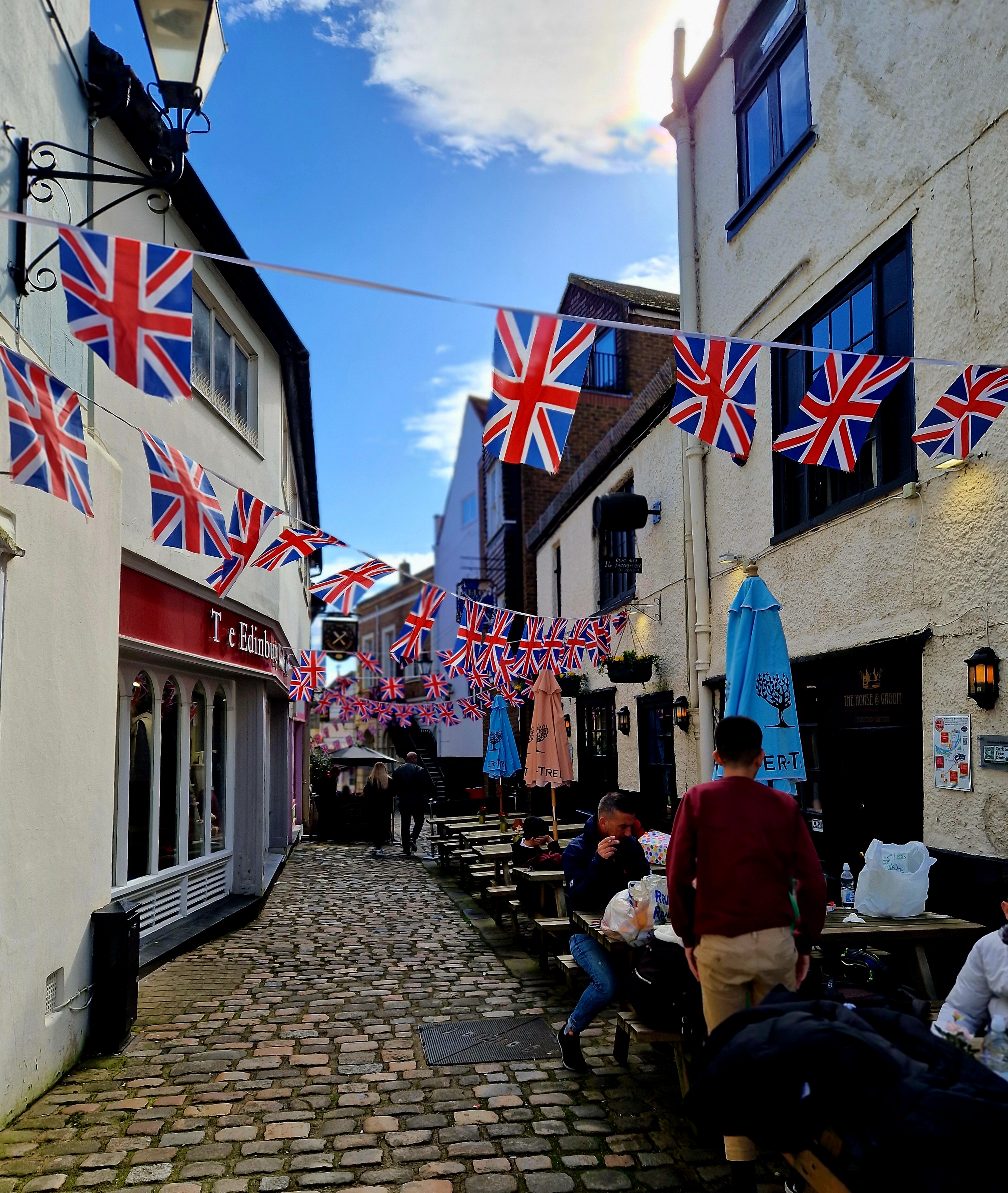


I stopped in the Carpenters Arms for a debrief drink after my walk.

I then walked back to Windsor and Eton Railway station to catch the train back to Staines. Another great walk!
