Sunday, 12 May 2019

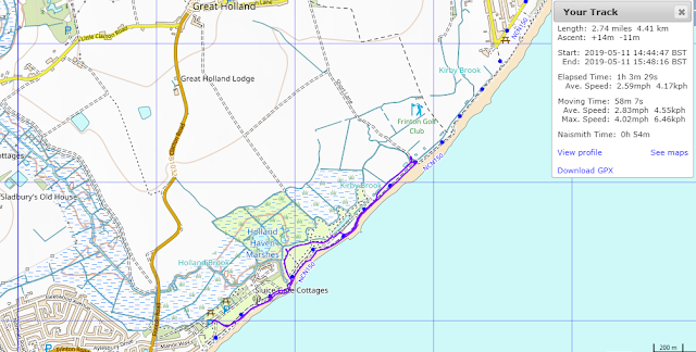
Holland Haven, Holland On Sea Walk 11th May 2019


On Saturday the 11th of May 2019, My dog Ben and I drove up to Holland Haven at Holland on Sea for a walk.

GPX file here
Viewranger file here
We parked at the Holland Haven car park which isn't cheap at £2.50 for 2 hours, next time I'll park on the seafront and walk in I think.

I walk along the beach pass the brightly coloured beach huts.


Passing the Gunfleet Sailing Club

The Gunfleet was the name of the large estuary fed by the Holland River or brook, which formerly ran into the sea between Frinton and Little Holland. The name is probably Anglo-Saxon in origin, as the second element ‘fleet’ is derived from the Old English word fleot meaning ‘stream’ or ‘creek’. A similar well known example is the River Fleet in London, a tributary of the River Thames which was fed by streams on Hampstead Heath and which used to have a tidal inlet and docks at its lower end. The origin of the first element of the name ‘Gun’ is currently unknown, but it possibly derived from an Anglo-Saxon personal name, so the meaning of the whole name could be something like ‘Gunna’s creek’. An alternative suggestion that has been made is that the first part of the name could be a corruption from the Count of Guisnes who possessed the manor of Little Holland in 1210.

However, the name was not recorded until 1320 when a vessel was shipwrecked on ‘Gunfletsond’, that is to say the Gunfleet Sands. It seems probable that a name originally applying to the estuary was appended to the sandbank that lay directly off the coast and opposite the estuary’s inlet. A map of 1584 in the British Library marks both the ‘Gonflet haven’ (the estuary) and the ‘ye gonflit’ (the sandbank). Other maps from that period, such as maps of Essex by Norden (1594) and Speed (1610) show the Gunfleet as a large, unreclaimed, estuary that was open to the sea at its southern end. The use of the name ‘haven’ would seem to imply the use of the estuary for trade, and the ‘Ganflete’ was also named as a port between Walton and St Osyth in Holinshed’s Chronicles (1586). The substantial marshlands along the estuary were also used by the inhabitants of surrounding parishes like Great and Little Holland as grazing for their sheep.


The reserve was the proposed landfall point for power cables to an offshore wind farm development on nearby Gunfleet Sands. A drilling rig was to be sited in the disused quarry but the Great Crested Newt came to the rescue and this didn't occur.
We approach the first hide ( a metal container) on the reserve.


The site itself allows viewing across a medium sized scrape along with a pond area, to the right from a large elevated 'container hide'. This can be found by walking approximately 500 yards northeast of the carpark, via the sluice. The scrape can provide good ‘all year round’ birding, although spring and autumn are best for scarce waders such as Temminck's Stint and Pectoral Sandpiper. 


There is also a chance of outstanding local rarities, such as Lesser Yellowlegs and Marsh Sandpiper, both of which have been recorded over the years. Cattle Egret, Citrine Wagtail and Marbled Duck have been seen here and in the surrounding fields and grazing marsh in recent years. The rough grassland surrounding the scrape is attractive to owls and raptors.

From the hide I could see Little Egrets and shelduck, wished I'd bought my binoculars.


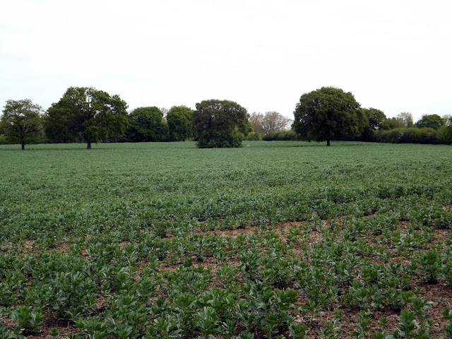
View to Great Holland


We pass the second hide and then rejoin the seawall.


Now it starts to pelt with rain, I have no waterproofs with me so the plan to walk over to Great Holland is abandoned.

We turn around and trudge on through the cold rain.
At reaching the golf course here, the only other undeveloped piece of land between Walton and Clacton on the course other than the reserve, we turn about and head back.


We pass one of the couple of Pill boxes here.Holland-on-Sea was known as Little Holland, a small village until the early 20th century.

During the Second World War Holland-on-Sea was fortified against German attack. There is a martello tower in nearby Clacton, which was also used during the Second World War. There is a Second World War pill box in Holland Haven Country Park. After the Second World War Holland-on-Sea went back to being a holiday town.

The rain stops and the welcome sun returns.

The tall Radar tower in the distance reappears,this is one of 12 that watch over the 26,000 ships passing through the Thames Estuary each year. It is unnamed and linked to the Port Control Centre in London by Microwave.


Wind farm out at sea


As we walk back across the grass from the beach I come across a large rock with a metal plaque that read;

' AW PROJECT CLEANWATER

For cleaner beaches at Holland and Clacton

The Lady on the Bike grew and presented an Oak tree to Anglian Water in tunnelling achieved with 100% safety while building a 2.1 metre diatmeter sewer from Holland Haven to Anglefield Clacton in 1997 '

This commemorates a seven mile tunnel built by Anglian Water in world record time to take sewerage from Clacton to treatment works in Holland Haven.  No idea what the lady on the bike and oak tree is all about though!!

We return back at the car at just under 3 miles, a short walk marred by bad weather.


Monday, 6 May 2019

Hanningfield Reservoir,Essex Bluebell Walk 6th May 2019

Viewranger file here
GPX file here

On Bank Holiday Monday the 6th of May 2019 I met Dan at the Essex Wildlife Trust Visitor Centre at Hanningfield Reservoir. Only to be told as we walked away from our cars by a member of staff that dogs are not permitted in the reserve. Madness,something to do with disturbing wildlife. But hey I wan't going to let that stop me doing this walk. So I decided to do the walk in reverse as we wouldn't have to go through the visitor centre.

The reservoir is one of the premier fisheries in the UK providing some of the best reservoir trout fishing by either bank or boat.
The reservoir is the 11th largest reservoir in England with an area of 3.5 square kilometres (880 acres). The reservoir was formed by W. & C. French in 1957 at a cost of about £6m, by flooding an area of South Hanningfield covering the ancient hamlet of Peasdown.
Giffords Farm and Fremnells Manor were also flooded. Contrary to popular belief, no buildings survive under the water, however an earth removal machine was left 'in situ' and concreted over prior to filling. The reservoir was built in an area formerly known as Sandon Valley, and large parts of the reservoir and surrounding countryside have been developed as a nature reserve.

The Wind in the Willows Sculpture & Brass Rubbing Trail features stunning, large-scale wooden sculptures of characters from Kenneth Grahame’s much-loved book The Wind in the Willows, first published in 1908. All the favourite characters are there: Mole, Ratty, Toad and Badger – as well as two dastardly Weasels.
The trail follows paths through the stunning woodland of the Trust nature reserve, with fantastic views of the reservoir (which is owned by Essex & Suffolk Water). People can purchase trail guides in the Trust’s visitor centre and then embark in Mole’s footsteps, into the ‘Wild Wood’, to seek out the sculptures. Beside each sculpture is a brass rubbing, from which people can fill in images of the characters on spaces in the guide, by using the crayons provided.
The Trail opened to the public on Saturday 28 March, before an official opening event later this year. It is the latest is a series of The Wind in the Willows-themed activities and events at Essex Wildlife Trust Hanningfield Reservoir. Last year, The Wind in the Willows Wildlife Garden, which features Ratty’s Boat and Toad’s Caravan, opened.


We head off down Hawkswood Road and try to stay tight in as there is no pavement and fast cars!


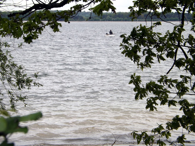
We pass by the reservoir and our first view of it.

We pass Crowsheath Fishery. The lakes are set in 110 acres of picturesque farmland, woodland and rolling countryside with an abundance of wildlife. There are three lakes at Crowsheath, the main carp and pike lake stocking carp up to 42lbs with 7 known 30′s and plenty of 20′s. With loads of pike up to lower mid twenties for a great bit of winter sport. There is a catfish lakeholding the UK’s largest mandarin catfish which has tipped the scales at 72lbs previously with other catfish up to 92 pound. There is also a coarse and carp lake and is perfect for a spot of float fishing or carpers who just want a bend in their rod.

At the bend of the road we take a path, I never intended to walk this way again after 3 years ago and the deep sloppy mud here. But I have no choice, be aware if you walk this way after a lot of rain, there will be deep mud!


A sign warns of Deep Sludge and a risk of sinking!

Thankfully today the mud is all but dried out for now!


We follow the footpath, but I wanted to get alongside the waters edge if we could, so I decide on trespassing. ( I have amended the GPX file so you don't have to). This was in vain as there was no way to get beside the water yet.

We could hear our first Cuckoo of the year, but unable to get a view of it.


We reach the Roy Widgery Hide.


Not much to see here today.

We follow the footpath onwards.

We pass The Hanningfield Sludge Treatment Reedbed system on our left.

A massive reed bed is breaking new ground in sustainable drinking water treatment in Essex. It is providing a natural method of dealing with the sludge which remains after drinking water treatment. Northumbrian Water has developed the first-of-its-kind reed bed system next to its Hanningfield Reservoir, near Chelmsford, operated by its Essex & Suffolk Water company. 16 reed beds, with a surface area of more than 10 acres, have been constructed and planted at a cost of £4.5million. The eye-catching natural plantation recently completed is now an essential part of the drinking water treatment process for the nearby water treatment works. Up to 240 million litres of water a day from Hanningfield Reservoir are treated to supply drinking water to a large part of Essex and part of east London; including Southend, Thurrock and the London Boroughs of Barking, Dagenham, Redbridge.


Now after a bit of walking we are able to take a path off to our right and head on down to the waters edge.

Hanningfield Waterside Park, set within a picturesque part of Essex, is regarded by many as the best any method premier still water trout fishery in the UK. It is one fishery you do not want to miss out on! This season they will be stocking a minimum of 50,000 high quality rainbow trout, along with 1,000 home reared specimens that will include fish weighing 10lbs and up. With the options of fishing off the top of the dam, from the natural bank or from one of our 35 Coulam motor boats, every time you fish you can experience something different.


We stopped for a short break and something to eat and drink before walking on.


A mute Swan


A female Mallard and chicks

We pass a small herd of sheep on the verge behind a fence I assume to control the grassbanks.


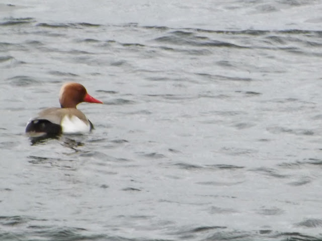
Red-crested pochard


Now we reach another carpark on Middlemead and we take the footpath back down to the waters edge.


This was soon to prove a mistake as the footpath comes to an abrupt end and into dense overgrown vegetation. We had no choice but to double back on ourselves and up to the road. The GPX file has been amended so you won't have to make the same lengthily mistake.


We are now back on Middlemead and following the road along.


South Hanningfield is over 100 years old. It’s the smallest of three villages (the other two are Downham and Ramsden Heath) which form the parish of South Hanningfield. 

However, the name of Hanningfield goes back a long way. It means a portion of cleared forest land which was once owned by the family Hann or Ham, who was thought to be a Saxon tribal leader. At the Norman conquest the lordship of the manor of Hanningfield was given to the Bishop of Bayeaux and later, in the 16th century, descended through the Montchesney famly to John, the first baron Petre of Writtle, and has remained in the family to the present day. 

The village was formerly a community where most of the inhabitants worked on the land and allied industries up to the 1940s when the war interrupted its lifestyle. During the 1950s there was a major upheaval in the village when the Hanningfield Reservoir was constructed. The village still retains its original appearance.

We pass South Hanningfield Hall, last sold in 1996 for £996,000 and now estimated to be at £2.1 million.


St Peter’s Church

From evidence in the north wall, the parish church of St Peter's originated in the late 12th or early 13th century. The windows and glass reflect the history of the church and its time. Norman churches like St Peter's were built on hills, however small, to give tactical advantage to defend against attack from foreign invadors.

The following are the dates when the main parts of St Peter's were built:

Nave 1180-1220

Windows, very small and high 1180-1220

Tower c1450 (restored 1888)

Porch c1450 (restored 1905)

Chancel 1850

The centre of South Hanningfield is situated around the village green, known as the Tye. A village hall is located on the east side of the Tye, while on the west side is a pub, the Old Windmill. There are approximately 80 households in the village.
We take another rest on the bench before continuing on along South Hanningfield Road.


We pass the Old Windmill pub.

The Old Windmill was built in 1702, and has been a public house at least from 1799, when records show that Joshua Appleton, Licensed Victualler, held the lease for 14 years. From 1848, William Hunt, described in a census as a Licensed Victualler and Farmer, had the pub.

We turn right onto Giffords Lane and down to the Waterside once more.


With its spectacular views over the reservoir and surrounding countryside we reach the Café on the Water and Gift shop.

It is here that you can also hire the boats out, but we didn't linger as we didn't want to get caught being there with Ben my dog.

Now we enter the woods and the bluebells.

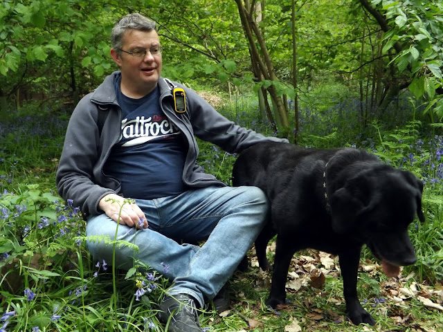
Spring just isn't Spring without a bluebell walk!


Fire beaters

Now we continue along the path passing the delightful Wind In The Willows characters. I loved that book when I was a child.

Ratty

The Mole


The Weasels

Mr Badger

The Otter
We now reach the Visitor Centre where we should exit, but again as we shouldn't be in there with the dog, we walk along another path that runs parallel with Hawkswood Road, but it is heavily fenced in and after a long distance we find a gap we can get through and walk back along the road to the car park. The GPX file has been amended to remove this. Our walk was 8.7 miles but with the amendments yours should be shorter.
A lovely walk out just a shame they ban dogs!