Showing posts with label Bluebell walk. Show all posts

Wednesday, 15 April 2020

Bluebell Walk , The Manor Harold Hill 14th April 2020

A short walk around The Manor in Harold Hill, being on lock-down during the Corona Pandemic is restricting me getting out on walks. But this is local and meant I still get to experience my yearly Bluebell Walk fix.


 Manor includes almost twenty hectares of colourful wildflower meadows, over eight hectares of ancient coppiced woodland, ponds, scrub and veteran trees. Not only that but the site also preserves a fascinating historical record which stretches back into the Middle Ages. Dagnam park, formally laid out by the well known Victorian landscape architect Humphrey Repton, preserves its original 18th century boundaries together with a number of original landscape features including copses, ponds and specimen trees. Look out for mature conifers, horse chestnuts and cedar.

I listened to the sounds of the birds singing. It was so peaceful and calming. But you can hear the distant hum of traffic on the M25 unfortunately breaking the silence.

A herd of deer emerged from the woods and started to gather on the green out in the sun.


The site of the original house is now overgrown, but a line of yew trees survives in woodland close to the spot where 19th century cast-iron gateposts flank the former drive. There is also a scheduled ancient monument, Cockerell's moated site (of Dagnam Park Farm), in the south of the site - now a well known breeding pond for great crested newts. There is also evidence of medieval field patterns and see if you can spot the medieval road running along the sites eastern boundary!

I walked past the site of the old manor house, where there is still some evidence of its exsistence, there are still part of walls, gate posts and the pond.


The first house at Dagnams (also known as Dagenhams) was a moated Tudor building sited at the southern end of a local wood called Great Hatters. From the early 13th century the manor was held by a series of local squires and merchants until c1420 when passed into the trusteeship (for whom it's not known) of the Duke of Gloucester, the Earl of March and others. By 1443 it was owned by the Earls of Northumberland until 1482 when it was sold to one Avery Cornburgh. Just before his death in 1487 he sold the manor to Sir William Hussey. On his death in 1495 it passed to his son, Sir John Hussey, a powerful official within Henry VII's household. The house then passed through the Grocers Company (who had inherited it), via the Legatt family, to Cromwell's physician, Dr Lawrence Wright in 1633. The only known image of the house from this time dates from 1633 and was probably commissioned by the proud new owner. It shows a gabled house, built round a courtyard, within a square moat. Thomas Wright died in 1657. It was rebuilt c1660 on a modest scale by his son Sir Henry Wright Bt. only a few years before he himself died in 1664. As an indication of size, it was noted that it had 23 hearths in 1662 and 24 in 1670. The famous diarist Samuel Pepys visited Dagenhams in July 1665 and said that "...it was the most noble and pretty house, for its size, that he had ever seen.".

The house underwent further extensive alterations and was enlarged between 1732 and 1739 by Edward Carteret, who also added a private chapel. It was noted in 1771 that Dagnams had a central block of two storeys with attics, containing eleven bays which may have been the original house of c1660. Carteret's extensions meant that this central block was flanked at each end by five-bay wings, also of two storeys, but without attics - creating a very large, 21-bay house, but shallow at only four bays deep.

In 1772 the estate and the neighbouring one, Cockerels, were sold to a wealthy merchant, Sir Richard Neave, Bt. (b.1731 - d.1814 - created Baronet in 1795). He had made his fortune trading in the West Indies and the Americas and had, at various times, been chairman of the Ramsgate Harbour Trust, the West Indian Merchants and the London Dock Company, as well as a director of the Hudson’s Bay Company and was made deputy Governor of the Bank of England in 1781 and promoted to Governor in 1783; a postion he held until 1785. He lived in the nearby Bower House in Havering-atte-Bower but sought to elevate himself from merchant to country gentleman. To reflect his achievements and new status Neave had the original Dagnams demolished, probably between 1772 and 1776. Its replacement was a red-brick Georgian house nine bays wide by four deep with a curved central three-bay projection to the south front.

Neave then set about consolidating his position by instituting a land purchase policy in 1785 which his successors continued for the next 100 years, ultimately creating one of the largest estates in south Essex. Estimated at approximately 500 acres in 1772, by 1846 it extended to over approximately 1,700 acres of land in Havering and Romford, and by 1876 to 1,800 acres reaching its zenith in the early 20th century when it extended to over 2,700 acres.

As with many country houses, the end of the First World War also signalled the start of the decline of the English country house which was to last until the 1970s. Before WWI Dagnams employed over 40 staff, however, in 1919 Sir Thomas L.H. Neave sold 2,200 acres, including 1,500 acres in Romford and Havering, leaving 500 acres surrounding Dagnams.

The 5th Baronet, Sir Thomas Neave, died in 1940 and the house requisitioned and soldiers billeted in it with the grounds used as a transport park. If this wasn't enough to contend with, the house was severely damaged by a German V2 rocket in January 1945 which landed nearby. The explosion opened up large cracks in the walls.

The final nail in the coffin of the estate and the house was the Abercrombie report after the Second World War which recommended creating new housing estates on green field sites around the edge of London to house those who had lost their homes in the War. The aim was to build in the park but to retain the house as a community centre. London County Council compulsorily purchased Dagnams and the remaining 500 acres for £60,000 (approximately £1.6m today) in 1947. They also bought another 850 acres which comprised the local farms which had been sold to the tenant farmers in the first land sale in 1919.

The house might have survived this radical change but for the actions of the caretaker installed by the council. Employed at wage of 30s per week and the use of 5 rooms for accommodation, he sought to supplement his income by promptly stealing and selling the lead from the roof. His actions also earned him an 18-month prison sentence but, worse, they allowed water to penetrate the building and especially the cracks left by the V2 rocket explosion. The combination of the bomb damage, the wear and tear of the soldiers, the extensive water damage and the lack of a clear need to preserve the house sealed its fate. Dagnams was demolished in late 1950 with the demolition team taking their payment in the form of the rubble to be sold as building material. The grounds became a public park and remain so to this day.

I walked through a part of the reserve I hadn't been before , then returning back to the path that lead me in.


The smell of the bluebell was heavenly as was the display they put on. I estimate about a 2.5 to 3 mile walk out in beautiful weather.

Monday, 6 May 2019

Hanningfield Reservoir,Essex Bluebell Walk 6th May 2019

Viewranger file here
GPX file here

On Bank Holiday Monday the 6th of May 2019 I met Dan at the Essex Wildlife Trust Visitor Centre at Hanningfield Reservoir. Only to be told as we walked away from our cars by a member of staff that dogs are not permitted in the reserve. Madness,something to do with disturbing wildlife. But hey I wan't going to let that stop me doing this walk. So I decided to do the walk in reverse as we wouldn't have to go through the visitor centre.

The reservoir is one of the premier fisheries in the UK providing some of the best reservoir trout fishing by either bank or boat.
The reservoir is the 11th largest reservoir in England with an area of 3.5 square kilometres (880 acres). The reservoir was formed by W. & C. French in 1957 at a cost of about £6m, by flooding an area of South Hanningfield covering the ancient hamlet of Peasdown.
Giffords Farm and Fremnells Manor were also flooded. Contrary to popular belief, no buildings survive under the water, however an earth removal machine was left 'in situ' and concreted over prior to filling. The reservoir was built in an area formerly known as Sandon Valley, and large parts of the reservoir and surrounding countryside have been developed as a nature reserve.

The Wind in the Willows Sculpture & Brass Rubbing Trail features stunning, large-scale wooden sculptures of characters from Kenneth Grahame’s much-loved book The Wind in the Willows, first published in 1908. All the favourite characters are there: Mole, Ratty, Toad and Badger – as well as two dastardly Weasels.
The trail follows paths through the stunning woodland of the Trust nature reserve, with fantastic views of the reservoir (which is owned by Essex & Suffolk Water). People can purchase trail guides in the Trust’s visitor centre and then embark in Mole’s footsteps, into the ‘Wild Wood’, to seek out the sculptures. Beside each sculpture is a brass rubbing, from which people can fill in images of the characters on spaces in the guide, by using the crayons provided.
The Trail opened to the public on Saturday 28 March, before an official opening event later this year. It is the latest is a series of The Wind in the Willows-themed activities and events at Essex Wildlife Trust Hanningfield Reservoir. Last year, The Wind in the Willows Wildlife Garden, which features Ratty’s Boat and Toad’s Caravan, opened.


We head off down Hawkswood Road and try to stay tight in as there is no pavement and fast cars!


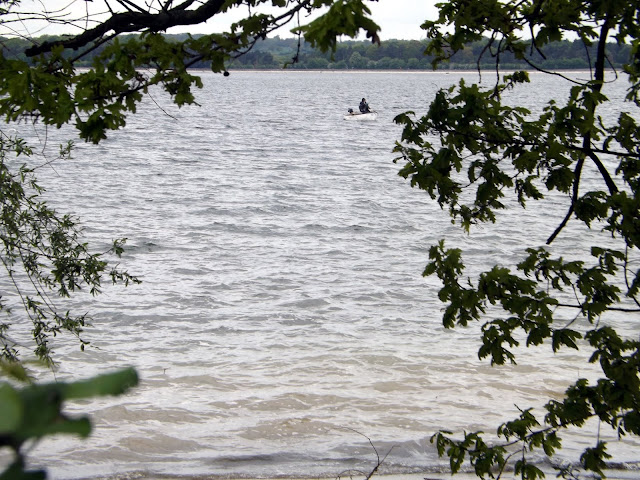
We pass by the reservoir and our first view of it.

We pass Crowsheath Fishery. The lakes are set in 110 acres of picturesque farmland, woodland and rolling countryside with an abundance of wildlife. There are three lakes at Crowsheath, the main carp and pike lake stocking carp up to 42lbs with 7 known 30′s and plenty of 20′s. With loads of pike up to lower mid twenties for a great bit of winter sport. There is a catfish lakeholding the UK’s largest mandarin catfish which has tipped the scales at 72lbs previously with other catfish up to 92 pound. There is also a coarse and carp lake and is perfect for a spot of float fishing or carpers who just want a bend in their rod.

At the bend of the road we take a path, I never intended to walk this way again after 3 years ago and the deep sloppy mud here. But I have no choice, be aware if you walk this way after a lot of rain, there will be deep mud!


A sign warns of Deep Sludge and a risk of sinking!

Thankfully today the mud is all but dried out for now!


We follow the footpath, but I wanted to get alongside the waters edge if we could, so I decide on trespassing. ( I have amended the GPX file so you don't have to). This was in vain as there was no way to get beside the water yet.

We could hear our first Cuckoo of the year, but unable to get a view of it.


We reach the Roy Widgery Hide.


Not much to see here today.

We follow the footpath onwards.

We pass The Hanningfield Sludge Treatment Reedbed system on our left.

A massive reed bed is breaking new ground in sustainable drinking water treatment in Essex. It is providing a natural method of dealing with the sludge which remains after drinking water treatment. Northumbrian Water has developed the first-of-its-kind reed bed system next to its Hanningfield Reservoir, near Chelmsford, operated by its Essex & Suffolk Water company. 16 reed beds, with a surface area of more than 10 acres, have been constructed and planted at a cost of £4.5million. The eye-catching natural plantation recently completed is now an essential part of the drinking water treatment process for the nearby water treatment works. Up to 240 million litres of water a day from Hanningfield Reservoir are treated to supply drinking water to a large part of Essex and part of east London; including Southend, Thurrock and the London Boroughs of Barking, Dagenham, Redbridge.


Now after a bit of walking we are able to take a path off to our right and head on down to the waters edge.

Hanningfield Waterside Park, set within a picturesque part of Essex, is regarded by many as the best any method premier still water trout fishery in the UK. It is one fishery you do not want to miss out on! This season they will be stocking a minimum of 50,000 high quality rainbow trout, along with 1,000 home reared specimens that will include fish weighing 10lbs and up. With the options of fishing off the top of the dam, from the natural bank or from one of our 35 Coulam motor boats, every time you fish you can experience something different.


We stopped for a short break and something to eat and drink before walking on.


A mute Swan


A female Mallard and chicks

We pass a small herd of sheep on the verge behind a fence I assume to control the grassbanks.


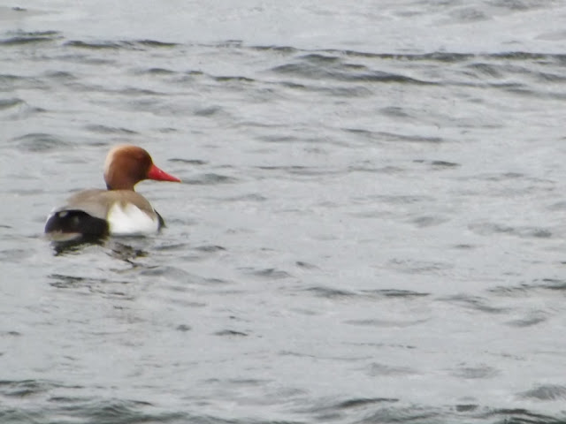
Red-crested pochard


Now we reach another carpark on Middlemead and we take the footpath back down to the waters edge.


This was soon to prove a mistake as the footpath comes to an abrupt end and into dense overgrown vegetation. We had no choice but to double back on ourselves and up to the road. The GPX file has been amended so you won't have to make the same lengthily mistake.


We are now back on Middlemead and following the road along.


South Hanningfield is over 100 years old. It’s the smallest of three villages (the other two are Downham and Ramsden Heath) which form the parish of South Hanningfield. 

However, the name of Hanningfield goes back a long way. It means a portion of cleared forest land which was once owned by the family Hann or Ham, who was thought to be a Saxon tribal leader. At the Norman conquest the lordship of the manor of Hanningfield was given to the Bishop of Bayeaux and later, in the 16th century, descended through the Montchesney famly to John, the first baron Petre of Writtle, and has remained in the family to the present day. 

The village was formerly a community where most of the inhabitants worked on the land and allied industries up to the 1940s when the war interrupted its lifestyle. During the 1950s there was a major upheaval in the village when the Hanningfield Reservoir was constructed. The village still retains its original appearance.

We pass South Hanningfield Hall, last sold in 1996 for £996,000 and now estimated to be at £2.1 million.


St Peter’s Church

From evidence in the north wall, the parish church of St Peter's originated in the late 12th or early 13th century. The windows and glass reflect the history of the church and its time. Norman churches like St Peter's were built on hills, however small, to give tactical advantage to defend against attack from foreign invadors.

The following are the dates when the main parts of St Peter's were built:

Nave 1180-1220

Windows, very small and high 1180-1220

Tower c1450 (restored 1888)

Porch c1450 (restored 1905)

Chancel 1850

The centre of South Hanningfield is situated around the village green, known as the Tye. A village hall is located on the east side of the Tye, while on the west side is a pub, the Old Windmill. There are approximately 80 households in the village.
We take another rest on the bench before continuing on along South Hanningfield Road.


We pass the Old Windmill pub.

The Old Windmill was built in 1702, and has been a public house at least from 1799, when records show that Joshua Appleton, Licensed Victualler, held the lease for 14 years. From 1848, William Hunt, described in a census as a Licensed Victualler and Farmer, had the pub.

We turn right onto Giffords Lane and down to the Waterside once more.


With its spectacular views over the reservoir and surrounding countryside we reach the Café on the Water and Gift shop.

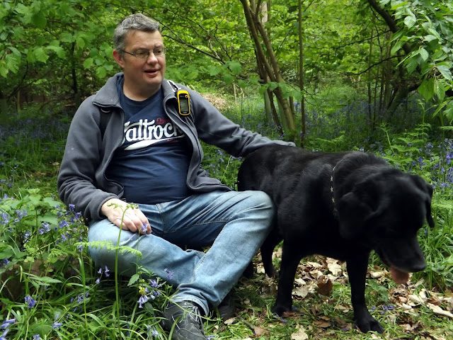
It is here that you can also hire the boats out, but we didn't linger as we didn't want to get caught being there with Ben my dog.

Now we enter the woods and the bluebells.

Spring just isn't Spring without a bluebell walk!


Fire beaters

Now we continue along the path passing the delightful Wind In The Willows characters. I loved that book when I was a child.

Ratty

The Mole


The Weasels

Mr Badger

The Otter
We now reach the Visitor Centre where we should exit, but again as we shouldn't be in there with the dog, we walk along another path that runs parallel with Hawkswood Road, but it is heavily fenced in and after a long distance we find a gap we can get through and walk back along the road to the car park. The GPX file has been amended to remove this. Our walk was 8.7 miles but with the amendments yours should be shorter.
A lovely walk out just a shame they ban dogs!