Viewranger file here
I left home on Monday the 12th of April 2021, this is the first day of Lockdown restrictions being lifted that allows me to stay away from home for the night. So I jumped at the chance to get away before they decide to throw us back into another lockdown. So I leave home at 5am for the three and a half hour drive to the Mam Tor NT car park.(SW33 8WA).
Driving up I really wasn't expecting to see snow on the hills, at least the roads were clear of snow.
 |
| View from the Mam Tor Car Park. |

I set off and start to climb the path up to the Mam Tor summit.

Mam Tor is a 517 m (1,696 ft) hill, its name means "mother hill", so called because frequent landslips on its eastern face have resulted in a multitude of "mini-hills" beneath it. These landslips, which are caused by unstable lower layers of shale, also give the hill its alternative name of Shivering Mountain.


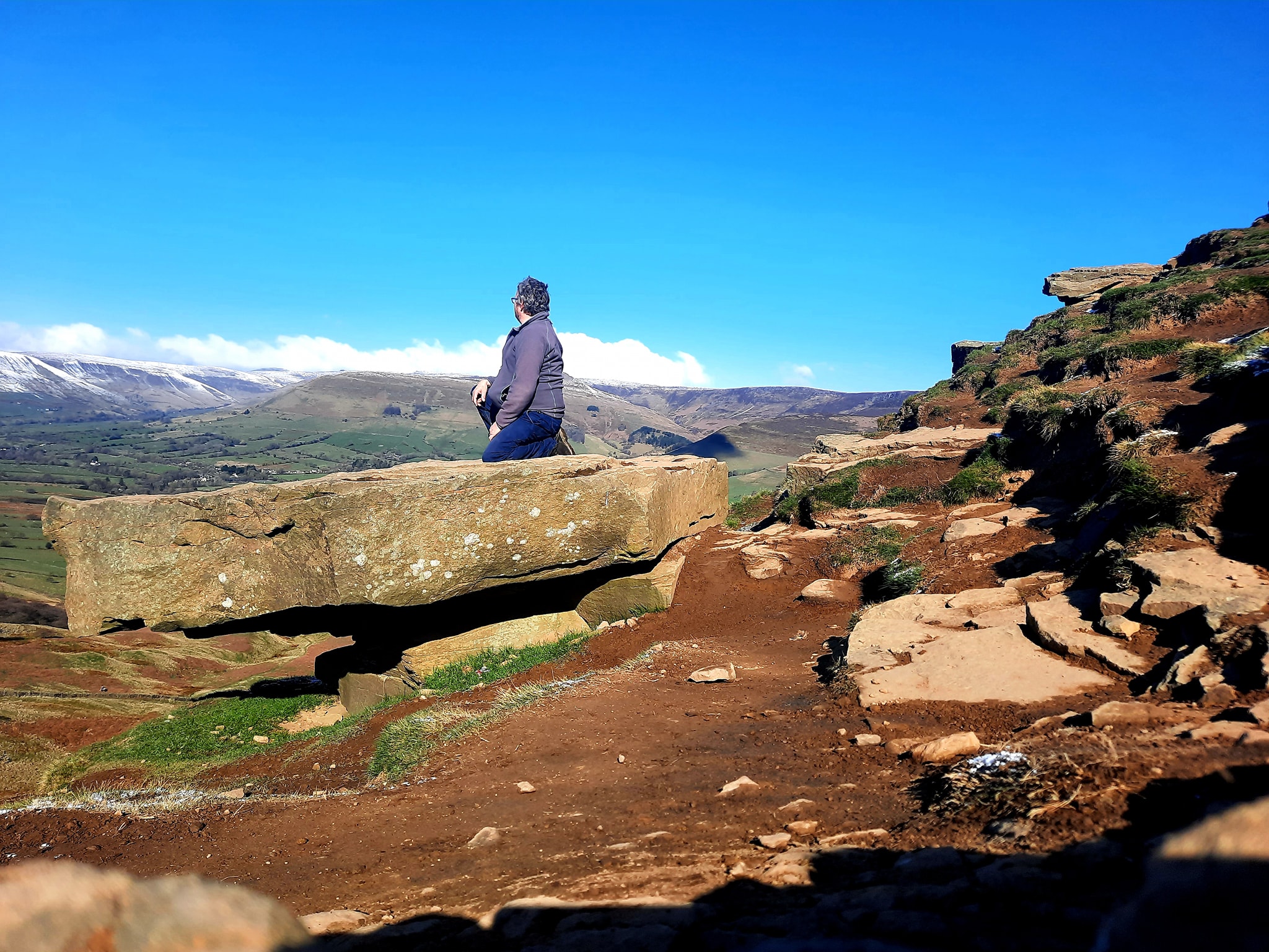
I reach the summit, where I meet two local photographers.

The hill is crowned by a late Bronze Age and early Iron Age univallate hill fort, and two Bronze Age bowl barrows.


In the distance I can see a factory spewing smoke out. One of the photographers told me that this was the Hope Cement Works and that Limestone is so very important to this area.
The plant is mostly self-contained with its own shale and limestone quarries adjacent, with only fuel and small amounts of additives needing to be brought in.

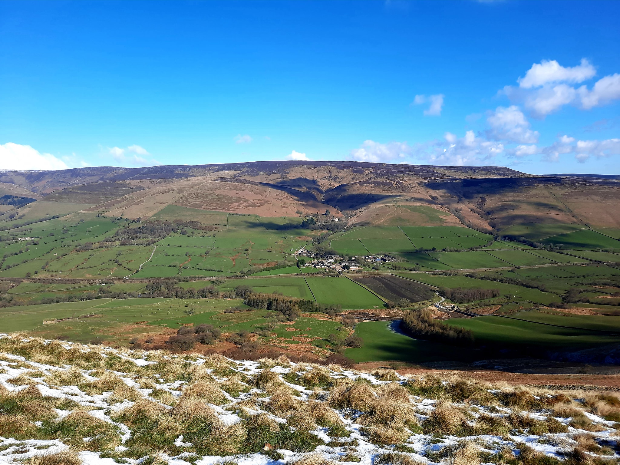
I walk on across the ridge towards Hollins Cross next.

Hollins Cross lies between Mam Tor and Lose Hill on the Great Ridge that separates Castleton and Edale.

Hollins Cross is the lowest point on the ridge and is therefore a popular route taken by walkers wishing either to cross from one side to the other, or to start a walk along the ridge. It was also the traditional route from Castleton to Edale. Coffins from Edale were taken over Hollins Cross to Hope church until a church was constructed in Edale, leading to the nickname of the "coffin road" for this route.

Hollins Cross is named for an actual cross which was raised here, but which had disappeared by 1905.


Walking along the path towards Back Tor now I slip on some mud and end up on my arse. Great this will be a good look later in the pub!


Back Tor comes into view with a lonely tree perched on top.

Back Tor is 538 metres (1765ft) in Height.

I climb up the path, there are workmen busy here laying a stone path to its summit.
Not sure if I was allowed along the path, I walk up anyway saying a hello as I passed.

Now I take a brief rest at the top, I make my way on towards Lose Hill.


I start the climb up to Lose Hill now.

Local access activist G. H. B. Ward was given an area of Lose Hill by the Sheffield and District Federation of the Ramblers Association in 1945, which was named Ward's Piece; he subsequently presented this to the National Trust.

I reach the summit of Lose Hill where I stop for a bite to eat, taking in the views of the Hope valley below.

Suggested explanations for the name of Lose Hill include that it derives from the Old English hlose, meaning pigsties, or that it may be a corruption of ‘loose’, as in ‘free land’. Another author (Murray) argues that Lose Hill should actually be called Laws Hill.

In relatively recent times, the two hills' names have prompted a fanciful tale concerning the outcome of an imagined 7th-century battle between the forces of Edwin of Northumbria and Cynegils of Wessex. Edwin's forces occupied Win Hill, while Cynegils' men camped on Lose Hill. As the battle progressed, Cynegils' forces advanced up Win Hill, and Edwin's retreated behind a temporary wall they had built near the summit. They pushed the boulders of the wall downhill, crushing the Wessex soldiers and gaining victory in the battle. However, there is no historical basis for the tale, and no evidence of any battle ever being fought here.


I follow the path off Lose Hill down towards Castleton.


I follow this through Lose Farm and Riding House Farm.


 |
| View of Peveril Castle in the distance. |
I walk now along the road into Castleton.

Peveril Castle is a ruined 11th-century castle overlooking the village of Castleton. It was the main settlement (or caput) of the feudal barony of William Peverel, known as the Honour of Peverel, and was founded some time between the Norman Conquest of 1066 and its first recorded mention in the Domesday Survey of 1086, by Peverel, who held lands in Nottinghamshire and Derbyshire as a tenant-in-chief of the king. The town became the economic centre of the barony. The castle has views across the Hope Valley and Cave Dale.

I walk through this lovely looking village, shame so much is still closed.


I pass St Edmunds Church.
The church dates from the 12th century, and has some 14th-century elements. Alterations were carried out in 1831 when the south porch was built, and the aisles were demolished. A restoration was carried out in 1886 by Hill Brothers of Tideswell.
The tower of St. Edmund's contains a ring of eight bells, with the heaviest six cast in 1802, and two trebles cast in 1812. All bells were cast by James II Harrison, and are unusual for their light weight (11 hundredweight), while being in the key of E-flat. Modern, tuned bells in this key normally weigh in the region of 20 hundredweight.

I stop in an antique shop, where I buy myself a German Stein. I ring the bell to pay and a elderly gentlemen (73 as he was eager to tell me) appeared. He looks at me and asks "You like big jugs do you?" I answered "yes" on the third time of asking I answered "I love big jugs" he replies "Great I'll go get the wife!". He seemed amused. He then thanked me as this was his first sale for months as the lockdown had seen him close.


\I walk on through the village to pick up the path back out.

I pass the beautiful Peakshole Water that flows through the village.


I take the path beside Peak Cavern.

Now I find myself climbing back up again out of the valley.


The path brings me out onto Arthurs Way and the bottom of the Winnats Pass.

I pass the closed Speedwell Cavern or also known as The Devils Arse.
Speedwell Cavern is one of the four show caves in Castleton.

The cave system consists of a horizontal lead miners' adit (a level passageway driven horizontally into the hillside) 200m below ground leading to the cavern itself, a limestone cave. The narrow adit is permanently flooded, so after descending a long staircase, access to the cave is made by boat. At the end of the adit, the cavern opens up with fluorspar veins, stalactites and stalagmites, and the so-called "Bottomless Pit". This chamber has an underground lake with a 20 metres (66 ft) high waterfall and an extremely deep vertical shaft, now choked to within 20 metres (66 ft) of the surface by rock spoil dumped by miners. The original depth of the shaft has been estimated, from the amount of spoil placed in the shaft over the years, at around 150 metres (490 ft).
The mine was developed in the 1770s but the limited lead ore deposits meant that it was not profitable and it was closed down by 1790.
At the foot of Winnats Pass, it is a popular tourist attraction with an underground boat trip to the cavern. Originally the guide propelled the boat by pushing against the walls with his hands, later the boat was legged through, and now it is powered by an electric motor.
A connection was discovered in 2006 between the Speedwell Cavern system and Titan, the largest natural shaft in the UK, which is 141.5 metres (464 ft) high.

I take a path behind and start a steep climb up to Treak Cliff Cavern.


Treak Cliff Cavern in Castleton is famous throughout the world for its unique and large deposits of Blue John stone and houses some of the most beautiful cave formations found in the UK.

Blue John (also known as Derbyshire Spar) is a semi-precious mineral, a form of fluorite with bands of a purple-blue or yellowish colour. In the UK it is found only at Blue John Cavern and Treak Cliff Cavern . During the 19th century, it was mined for its ornamental value, and mining continues on a small scale. Deposits of fluorite have been recently found in China with colouring and banding similar to the classic Blue John stone.
There several shops in Castleton where you can buy some.
 |
| Down below is where I intended to park, but I opted to park near to the next days walk and a pub! |

The path continues top climb steeply upwards.


At the top of the path I reach the closed Cafe and Blue John Cavern. I walk on taking a wrong turn slightly and arrive at the top of the Winnats Pass. I later drive down this spectacular pass.
The name Winnats comes from ‘Windy Gates’ as one of the windier entrances into Castleton and the Hope Valley.
This limestone valley was once under a tropical sea- the limestone is full of fossils of sea creatures which lived here over 350 million years ago. This makes Winnats Pass a protected site, by law, known as a Site of Special Scientific Interest (SSSI). Rocks and plants are not allowed to be removed from here. The valley was created by melting glaciers wearing away the rock – the limestone gradually dissolved and streams flowed through and under cracks and fissures in the rock. One of these streams created a large underground cave system which eventually collapsed, leaving the steep-sided valley you can see now.


I walk back onto the correct path, across Windy Knoll.

I eventually arrive back at my car after a 8 mile walk.

I drive onto Ladybower Inn beside the Ladybower Reservoir where I will spend the night.

I have my first pint of Batemans XB at the pub after they've been closed for months!


 |
| Great views for tonight's stay in the car. |
I walk up the road to see some of the reservoir.


I stopped to admire the Plughole here.

Technically known as shaft spillways but affectionately known as plug holes, the drains were designed to regulate water levels in the reservoir by letting out water when the reservoir became full after prolonged wet spells.
The water is carried away down tunnels through the dam to the River Derwent downstream.
Each plug hole has a diameter of 24m (78ft) and the drop from the exit point to the floor of the tunnel below is 20m (66ft).
These shaft spillways have been nicknamed bellmouth or morning glory - after the flower - spillways.

I stopped at the Yorkshire Bridge Inn, not impressed with the ale selection, I returned to Ladybower Inn for another pint and fish n chips.

Then get a good nights sleep in before tomorrows walk!