Showing posts with label Norway. Show all posts

Monday, 7 July 2025

Haugesund, Norway 3rd July 2025 on P&O Iona

On Thursday the 3rd July 2025 I awoke onboard Iona and turned on my cabin TV and got the below picture from the Bridge webcam as we sailed into Haugesund in Norway.

We go up to Horizons for breakfast and sit out on deck taking in the views.


We get the lift down to deck 3 and disembark. We have a look in the souvenir shop right by the mooring and then we walk out into town.
 
First time I've ever seen a seaplane, so I had to take a photo!

Haugesund is a municipality and town on the North Sea in Rogaland county, Norway. As of December 2023, the municipality of Haugesund has a population of 37,855. The vast majority of the population (37,008) live in the Haugesund urban area in the municipality's southwest. Haugesund is the main commercial and economic centre of the Haugaland region in northern Rogaland and southern Vestland. The majority of the municipality outside this area is rural or undeveloped.

We cross the bridge on Risøy bru over the water that separates the dock area and the main town.
We have a quick look about and then we walk back onto Strandgata to catch the bus to The Rising Tides artwork installation. We board the 201 bus and I attempt to pay with a credit card, either cards aren't accepted or the driver didn't understand. Anyway he just told us to get onboard, we travelled a short distance to the GARD bus stop and alight here and we follow the signs that lead us to Haraldshaugen.
After a short walk we reach the coastline.

Haraldshaugen

Before we walk over to Haraldshaugen we stop and walk up the small mound to Krosshaugen.

Krosshaugen is a stone cross dating from the earliest Christian period in Norway (about 1000 AD). This location has functioned as a Parliament site and the cross may be a monument to the farmers who converted to the Christian faith during sessions of Parliament. It is believed that Christian mass was performed beside these stone crosses before churches were built.

View to Haraldshaugen from the cross.

Krosshaugen, one of 60 stone crosses in Rogaland, is also found in this area. The stone cross is from the earliest period of Christianity in Norway. It may commemorate the farmers adopting the Christian faith at the ting assembly, and the Christian mass is also believed to have been read at these stone crosses before a church was built.


We walk on over to Haraldshaugen.

Haraldshaugen was erected to commemorate the unification of Norway by Harald Fairhair. The monument is located at Gard, 2 km north of Haugesund.

Snorre Sturlason’s kings’ sagas make reference to the site where Harald Fairhair was buried, which is believed to have been found last century. The national monument was erected on top of this mound in 1872, to mark the millennium celebration of Norway’s unification into one kingdom.

It was designed by architect Christian Christie, as a large burial mound surrounded by a granite wall with 29 standing stones, each representing one of the old Norwegian counties. A 17-metre granite obelisk with four bronze panels around its base stands at the top of this mound. Each panel depicts important scenes from the life and times of Harald Fairhair.

We leave Haraldshaugen and follow the coast path along. It says to allow 40 minutes for this walk.

The coastal path itself is about a 6-km round trip and takes around 1 hour. If you start from Haugesund town centre, you need to add about 30 minutes each way.

We pass some lovely huts framing the shoreline and the North Sea beyond.


We encounter wild goats and George in his eagerness to go say hello to the goats twisted his ankle slightly on uneven ground. After a short rest thankfully he's done no damage.

We walk on passing a path that leads you down to Kvalen fyr, a lighthouse on a peninsula that leads out to sea.

The lighthouse stands proud at the entrance to the Haugesund harbour in Norway. Designed by Severin Aasen, the unlit structure dates back to 1864 and stands 36 meters tall. It is cast in brick and is crowned with a unique “rhomboid” roof. Haugesund Lighthouse is a symbol of the longstanding maritime tradition of the town, and can be seen from Hinna Park, a small park situated behind the Western edge of the town. From here you can observe the lighthouse, as well as many picturesque scenes of the town, including striking views across the estuary. The lighthouse is now an iconic image of the city of Haugesund.


We walk on and the path meets the road (Kvalsvikvegen) which we follow a short way and we reach the Rising Tides statues.

The Rising Tide is a tidal artwork that depicts a series of working horses with riders, which are loosely based on the four horsemen of the Apocalypse. They were originally exhibited in the River Thames positioned within sight of the Houses of Parliament in 2015. Each was submerged and revealed by the tide river twice daily.

The horse’s heads have been replaced by an oil well pump or a “nodding donkey” as they are also known. The suited figures illustrate an attitude of denial or ambivalence towards our current climate crisis and the young riders represent hope in effecting future change.

The sculptures symbolise our desire to control natural forces, but their position in a vast body of moving water highlights our inherent fragility. It is intended to provide a disturbing metaphor for rising sea levels, demonstrating how little time we have to act, yet crucially it offers hope as it resets itself each day, offering us the opportunity for change.


Even though it was fairly busy here, there was still a calming feel to the place.


 After taking quite a few photo's , I try to see if I can get a uber taxi back to Haugesund. There are no cars available the app says!


The water was crystal clear and on closer inspection, I could see shrimps and some small fish like gobies.

So we walk back the way we came and once back at the Gard bus stop I book three tickets on the Kolumbus bus app I had downloaded. The bus arrives and we board and travel back to Haugesund town centre.

We get off at the Strandgata/Torggata bus stop and up the road we can see Our Saviours Church.

The church was designed by Architect Einar Halleland. The building is constructed in red-facing-brick and in a neo-Gothic, historical style. The tower is 160 feet high. The church was dedicated in 1901 and can seat 1030 people.

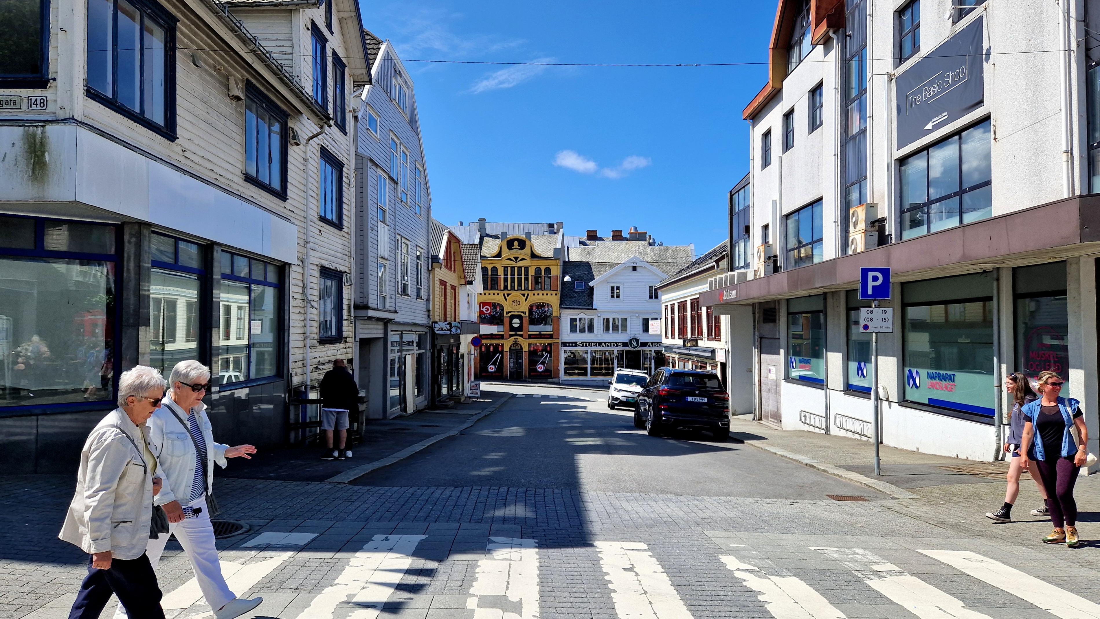
We walk around the many shops and pop in to buy some souvenirs.

The town is situated on a strategically important sound, Karmsundet, through which ships could pass without traversing heavy seas. In the early years, the coastal waters off Haugesund were a huge source of herring, and the town grew accordingly. Despite being barely a village back then, King Harald Fairhair lived at Avaldsnes, very close to the modern town of Haugesund. In the last decades, the town, like its neighbours, has been turning towards the petroleum industry, with the herring being long gone.


After much shopping and walking we decide to head back to the ship.

During the last 20 years, the municipality has established its position as the main trading centre for the Haugaland region and southern parts of Vestland county. It has several relatively large shopping centres, however, this has led to a decline of the trade and shopping activity in the town centre.

We cross back over the bridge we came over earlier, below are buildings connected to the Salted Herrings trade.

Once back onboard we have lunch and relax.

Later that evening we set sail and leave Haugesund and head for a day at sea tomorrow as we are homeward bound back to Southampton.


Despite being a fairly young town, the areas surrounding Haugesund were lands of power during the Viking Age. Harald Fairhair was the first king of Norway. He had his home in Avaldsnes, also known as Homeland of the Viking Kings, only 8 km (4.9 mi) from the present town. After his death in c. 940, it is believed Fairhair was buried at Haraldshaugen, a burial mound adjacent to the Karmsundet strait. This site is the namesake of the town and municipality of Haugesund. The national monument at Haraldshaugen was raised in 1872, to commemorate the 1000th anniversary of the naval Battle of Hafrsfjord in 872. The Battle of Hafrsfjord has traditionally been regarded as when western Norway was unified under a single monarch for the first time.


Haugesund has a strong historical bond to the sea and especially the herring. In the earlier years, the coastal waters of Haugesund were a huge source for fishing herring, and the town grew accordingly. The protective straits of Smedasund and Karmsund gave the town potential to grow in both fishing and shipping. Even to this day, Karmsund is one of Norway's busiest waterways. The town is still growing geographically even though the population has increased only moderately over the last decade. In modern times the herring stocks have been depleted and the town is turning towards the petroleum industry, like its neighbouring town to the south, Stavanger.

That night we had dinner in the main dining room and went to the silent disco, which was anything but. If you took your headphones off the sound of hundreds of people singing was deafening!

We watched Klaus Fantastiche in the theatre, he was actually quite funny. See video below. Not my video I must add!

Then to bed, day at sea tomorrow!

Flåm,Norway 2nd July 2025 on P&O Iona

On Wednesday the 2nd July 2025 I awoke and we all went up for Breakfast at Horizons onboard P&O Iona. Whilst having breakfast we had amazing views out to Flåm and Aurlandsfjord.

After breakfast we got ourselves ready and headed down to deck 3 and out into Flåm.

We head off and pass the Ægir Bryggeri Pub which I hope to visit later.

Ægir BryggeriPub

We walk into the centre of Flåm, where all the shops are.

Flåm (Norwegian pronunciation: [floːm]) is a village in the Flåmsdalen valley which is located at the inner end of the Aurlandsfjorden, a branch of Sognefjorden. The village is located in Aurland Municipality in Vestland county, Norway. In 2014 its inhabitants numbered 350.

We pop into several souvenir shops here.

The name Flåm is documented as early as 1340 as Flaam. It is derived from the plural dative form of the Old Norse word flá meaning "plain, flat piece of land", and it refers to the flood plains of the Flåm River. ("A plain between steep mountains" is the toponomy of the encyclopedia Store Norske Leksikon.)

We reached the Flam Railway. Many from our ship had a trip booked, we had not. I didn’t fancy being crammed into a small train full of people, Ive just spent days crammed full of people on a ship, I needed some space and quiet time. But we did visit the museum here.

The Flamsbana train takes you from Flam (situated at sea level) to the mountain station Myrdal (867 meters above sea level) and offers breathtaking views throughout the thrilling ride.

In the course of an hour, while your train is moving at 40km/h prepare to witness spectacular scenery including mountainsides, tiny, charming villages, foaming waterfalls, go through 20 tunnels and take pictures at many viewpoints. The hour will fly by!

What is more, 80% of your journey Flamsbana train will be running on a gradient of 5.5% proving Flam railway's title of being one of the steepest railways in the world. Many travelers believe that one return ticket for Flam railway is not enough to really appreciate the scenery.

The Flåm Railway Museum has no entrance fee. The museum offers a guided tour, in 9 different languages, with an audio guide from Voice of Norway. After downloading the app on your mobile, you can experience the tour with an audio guide in the museum.

With a pleasant narration, you will hear about the construction of the Flåm Railway and the history of Flåm. At your own pace, on your own mobile, you will get to know the authentic exhibition at the museum.

At your own pace, on your own mobile, you will get to know the authentic exhibition at the museum.

We visit the Flåm Railway Museum and discover the exciting stories behind the construction of the Flåm Railway, Europe’s second steepest railway. Listen to the audiovisual guided tour, which tells you about the hardworking people who built this masterpiece of a railway. As well as the many technical challenges during construction.

Almost next door to the museum is the Flåm Sweatershop, and outside we take photos with a giant Norwegian Troll.

Flåm Sweatershop is a delightful haven for tourists seeking authentic Norwegian craftsmanship. Located in the scenic village of Flåm, this charming clothing store specializes in high-quality sweaters and knitwear that embody the essence of Norway's rich textile traditions. As you step inside, you'll be greeted by the warm ambiance that reflects the cozy Norwegian lifestyle and the friendly staff eager to assist you in finding the perfect piece. The shop features an impressive array of sweaters, cardigans, and accessories, showcasing intricate designs inspired by nature and Norwegian folklore. Each item is crafted with care, ensuring that visitors not only take home a stylish souvenir but also a piece of cultural heritage.

A troll is a being in Nordic folklore, including Norse mythology. In Old Norse sources, beings described as trolls dwell in isolated areas of rocks, mountains, or caves, live together in small family units, and are rarely helpful to human beings.

In later Scandinavian folklore, trolls became beings in their own right, where they live far from human habitation, are not Christianized, and are considered dangerous to human beings. Depending on the source, their appearance varies greatly; trolls may be ugly and slow-witted, or look and behave exactly like human beings, with no particularly grotesque characteristic about them.

In Scandinavian folklore, trolls are sometimes associated with particular landmWe stop for a break on a picnic bench with views back to Iona, she looks beautiful sitting here in the fjord.arks (sometimes said to have been formed by a troll having been exposed to sunlight). Trolls are depicted in a variety of media in modern popular culture.

We stop for a break on a picnic bench with views back to Iona, she looks beautiful sitting here in the fjord.

We walk on and see the Flamsbana train sitting at the station, waiting to take the tourists on their journey. Flåm is heaving with tourists and on top of the cruise visitors many more coaches are arriving.
We decide its time to leave the hustle and bustle and start our walk to visit the Brekkenfossen waterfall.

We cross a bridge over the river Flåmselvi and walk along Nedre Brekkevegen and a campsite beside it.

The views are just jawdropping gorgeous. 

Further up were a herd of cows that we had to stop and say Hi to.

The village of Flåm has since the late 19th century been a tourist destination. It currently receives almost 450,000 visitors a year. Most ride the 20-kilometre (12 mi) Flåm Line between Flåm and Myrdal, one of the steepest railway tracks at 1 in 18 (not counting rack railways) in the world. There are also a few spirals. A former rail station building in Flåm now houses a museum dedicated to the Flåm railway.

Getting a photo of one, I leant forward and not noticing a wire, I get a big shock from the electric fence, Mel and George heard the surge as I touched it!

There are complaints of overtourism and suggested curbs on it.

Air pollution in Flåm and Geiranger during the cruise season is similar to that of a big city. Cruise traffic in Norway, which is one of the largest exporters of oil in the world, emits more NOx than all road traffic in Norway combined.

In 2009, Jens Riisnæs (an author and NRK journalist) said "We have the world's most beautiful nation, we don't need to follow the cruise operators' premises. They can go other places with their polluting ships. It is unwanted noise."

In 2009, Dagens Næringsliv said that a report by Vestlandsforskning says that both "Flåm and Geiranger are nearing a limit in capacity. It might be an alternative and rather stand forth as a «relaxed», exclusive and somewhat less of a mass tourism, cruise destination."

In a 2014 Dagens Næringsliv article, a farmer said that "Previously the smell of summer was that of grass that had been cut. Now the smell is of heavy oil".] Furthermore, "They [a retired couple] talk about fish that has disappeared from the fjord. In Norway, cruise ships are permitted to dump overboard their greywater in the postcard-narrow fjord-arms. Furthermore, the news article says that defecation in public by tourists, is already a problem; the village's train station has the only public toilets, and 200,000 tourists are expected in the summer season.

In 2014, tourism professor Arvid Viken said that "it is about time this [type of] tourism is evaluated somewhat more soberly than how it has been done in many municipalities for some years". Furthermore, this tourism "has low profit per tourist, but is often associated with considerable costs for" the municipal administrations.

As we walked on further we can see the waterfall in the distance.

Flåm was the birthplace of the poet Per Sivle. I know, I’ve never heard of him either!

We have now found the footpath after about 1.5km of walking and we start climbing up.

Its okay at first but then gets steeper and turns to huge steps. Its tough going, glad we bought plenty of water each.

This hike is a total of 5 km in length (return from Flåm centre). Total climb in elevation about 155 m.

Mel looks like she wants to give up, its tough and very hot. But the many people coming down give encouragement and says it is well worth the climb, so we continue upwards.

After quite a walk we stop at a mini waterfall in the shade and I dip my cap in the cool water to cool myself off.


We continue on, we were so close at that stop as we are now here at the waterfall viewpoint.

Brekkefossen is a powerful waterfall in the south-middle of Norway at Flåm, municipality Aurland, in the region Sogn og Fjordane. Most people will see this waterfall along the Flåmbanen by train. 

The views back down to Flåm and Iona sitting in the fjord was just amazing!

Brekkefossen. A powerful waterfall with an overall height of 100 metres, probably higher (800 metres) if you count in the rest of the river. Brekkefossen is fed by the rivers Ljosdøla/Brekkeelvi which has its origin at the Viddalsfjelett and Skratlandevatnet (lake) at an altitude of 1418 metres.


Brekkefossen was thundering and amazing from the small plateau on which numerous other hikers were resting and taking in the views. Gazing outwards and along the valley it was possible to trace the route we’d walked all the way back to Flåm and to see our cruise ship docked at the village port. Snow-topped mountains, fjords, a waterfall, wooden buildings nestled, wow!


The cooling spray from the waterfall was very welcoming. 


We walked back the way we came and were soon back in Flåm. We walked up to the edge of the Fjord and to Flåm beach. Mel and George took a rest, while I took a dip in the Fjord. 


It was cold, even by my standards. I wasn’t in for too long, but long enough to enjoy the scenery and take some photos!


We walk back and decide to to have a drink in the Viking hut themed pub, the Ægir microbrewery bar.

The wooden interior with its design reminiscent of stave churches or Viking halls , the chairs were amazing. Now how do I smuggle them out and aboard the Iona?


The beer was superb too with a range to suit all tastes.


I had aLærdøl Sour Cherry Rye(A crisp and tart thirst quencher),Mel had a Aegir Raspberry Pale Ale,(a pale, red and refreshingly tangy ale. The bitterness is well balanced against the redberry flavours from locally sourced raspberries taken from the foot of the Norwegian Fjord mountainside. Slightly tropical hop notes) and George opted for a cider.

Norway is pricey though and those 3 drinks came to £31!


We walked back onboard Iona and went straight for lunch, we were starving!

We set sail later that evening and on towards Haugseund our stop tomorrow.

We watched another strange show in the grand atrium before dinner later that night in the Opal Restaurant.

Goodbye Flåm,you were amazing!